Berltsum geodata
Berltsum (Friesland) is a populated place; located in Netherlands in Europe/Amsterdam (GMT+2) time zone. With population of 2,530 people, there are 832 cities with bigger population in this country. Compared to other cities in Netherlands, 95.5% of cities are located further ↓South; 50.1% of cities are located further →East and 83.9% of cities have higher elevation than Berltsum. Note1


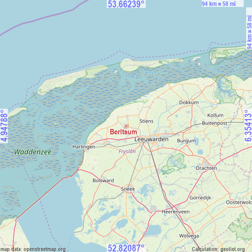
Berltsum GPS coordinates[2]
53° 14' 37.32" North, 5° 39' 3.636" East
| Map corner | latitude | longitude |
|---|---|---|
| Upper-left | 53.66239°, | 4.94788° |
| Center: | 53.2437°, | 5.65101° |
| Lower-right: | 52.82087°, | 6.35413° |
| Map W x H: | 93.6×93.6 km | = 58.2×58.2mi |
| max Lat: | 53.48025° ⇑4.5% North |
| Berltsum: | 53.2437° |
| min Lat: | ⇓95.5% South 50.76917° |
| min Long | Berltsum | max Long |
| 3.38611° | 5.65101° | 7.16528° |
| W 49.9%⇐ | ⇒50.1% E |
Elevation
Elevation of Berltsum is 1 m = 3 ft, and this is 14 m = 46 ft below average elevation for this country.
| Max E: |
203 m = 666 ft | 83.9% |
| Avg. | 15 m = 49 ft | |
| Berltsum | 1 m = 3 ft | |
Min E: |
-6 m = -20 ft | 16.1% |
See also: Netherlands elevation on elevation.city.
Geographical zone
Berltsum is located in North temperate zone (between Tropic of Cancer and the Arctic Circle). Distance of this North polar circle is 1481 km =920.3 mi to North.| Distance of | km | miles | from Berltsum |
|---|---|---|---|
| North Pole | 4086.9 | 2539.5 | to North |
| Arctic Circle | 1481 | 920.3 | to North |
| Tropic Cancer | 3314.2 | 2059.3 | to South |
| Equator | 5920.1 | 3678.6 | to South |


Nearby cities:
15 places around Berltsum: (largest is in red/bold)
• Bilgaard
10.1 km =6.3 mi,  108°
108°
• Britsum
9 km =5.6 mi,  82°
82°
• Deinum
7.6 km =4.7 mi,  139°
139°
• Dronryp
4.9 km =3 mi,  180°
180°
• Franeker
9.8 km =6.1 mi,  228°
228°
• Marsum
6.2 km =3.9 mi,  126°
126°
• Menaam
2.9 km =1.8 mi,  166°
166°
• Minnertsga
3.8 km =2.4 mi,  282°
282°
• Oude Bildtzijl
7.7 km =4.8 mi,  35°
35°
• Sint Annaparochie
3.6 km =2.2 mi,  6°
6°
• Sint Jacobiparochie
4.5 km =2.8 mi,  315°
315°
• Stiens
7.4 km =4.6 mi,  73°
73°
• Tzummarum
7 km =4.3 mi,  264°
264°
• Vrouwenparochie
5.1 km =3.2 mi, 39°
• Westeinde
8.7 km =5.4 mi,  116°
116°
Sources, notices
• [Note1] Compared only with cities in Netherlands existing in our database
• [Src1] Map data: © OpenStreetMap contributors (CC-BY-SA)
• [Src2] Other city data from geonames.org with taken over terms of usage.
• [Src3] Geographical zone / Annual Mean Temperature by Robert A. Rohde @ Wikipedia
