Brand geodata
Brand (North Brabant) is a populated place; located in Netherlands in Europe/Amsterdam (GMT+2) time zone. With population of 1,270 people, there are 1255 cities with bigger population in this country. Compared to other cities in Netherlands, 83.4% of cities are located further ↑North; 51.3% of cities are located further →East and 77.1% of cities have lower elevation than Brand. Note1


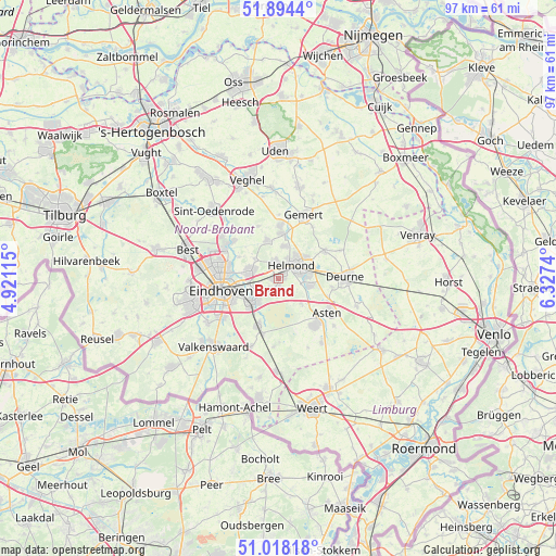
Brand GPS coordinates[2]
51° 27' 30.204" North, 5° 37' 27.372" East
| Map corner | latitude | longitude |
|---|---|---|
| Upper-left | 51.8944°, | 4.92115° |
| Center: | 51.45839°, | 5.62427° |
| Lower-right: | 51.01818°, | 6.3274° |
| Map W x H: | 97.4×97.4 km | = 60.5×60.5mi |
| max Lat: | 53.48025° ⇑83.4% North |
| Brand: | 51.45839° |
| min Lat: | ⇓16.6% South 50.76917° |
| min Long | Brand | max Long |
| 3.38611° | 5.62427° | 7.16528° |
| W 48.7%⇐ | ⇒51.3% E |
Elevation
Elevation of Brand is 19 m = 62 ft, and this is 4 m = 13 ft above average elevation for this country.
| Max E: |
203 m = 666 ft | 22.9% |
| Brand | 19 m 62 ft | |
| Avg. | 15 m = 49 ft | |
Min E: |
-6 m = -20 ft | 77.1% |
See also: Netherlands elevation on elevation.city.
Geographical zone
Brand is located in North temperate zone (between Tropic of Cancer and the Arctic Circle). Distance of this North polar circle is 1679.5 km =1043.6 mi to North.| Distance of | km | miles | from Brand |
|---|---|---|---|
| North Pole | 4285.4 | 2662.8 | to North |
| Arctic Circle | 1679.5 | 1043.6 | to North |
| Tropic Cancer | 3115.7 | 1936 | to South |
| Equator | 5721.6 | 3555.2 | to South |


Nearby cities:
15 places around Brand: (largest is in red/bold)
• Aarle-Rixtel
5.8 km =3.6 mi,  9°
9°
• Akert
6.7 km =4.2 mi,  222°
222°
• Coevering
5.7 km =3.5 mi, 217°
• Eeneind
5.4 km =3.4 mi,  262°
262°
• Geldrop
6.1 km =3.8 mi,  227°
227°
• Gerwen
5.5 km =3.4 mi,  309°
309°
• Helmond
3.6 km =2.2 mi,  44°
44°
• Lierop
5.8 km =3.6 mi,  138°
138°
• Lieshout
7.2 km =4.5 mi,  343°
343°
• Mierlo
2.1 km =1.3 mi,  189°
189°
• Muschberg en Geestenberg
7.2 km =4.5 mi, 256°
• Nuenen
5.1 km =3.2 mi,  284°
284°
• Schutsboom
0.4 km =0.2 mi, 341°
• Stepekolk
0.9 km =0.6 mi,  245°
245°
• Zesgehuchten
6.9 km =4.3 mi, 227°
Sources, notices
• [Note1] Compared only with cities in Netherlands existing in our database
• [Src1] Map data: © OpenStreetMap contributors (CC-BY-SA)
• [Src2] Other city data from geonames.org with taken over terms of usage.
• [Src3] Geographical zone / Annual Mean Temperature by Robert A. Rohde @ Wikipedia
