Spainkbos geodata
Spainkbos (Gelderland) is a section of populated place; located in Netherlands in Europe/Amsterdam (GMT+2) time zone. With population of 1,155 people, there are 1303 cities with bigger population in this country. Compared to other cities in Netherlands, 62.5% of cities are located further ↓South; 67.6% of cities are located further ←West and 78.8% of cities have lower elevation than Spainkbos. Note1


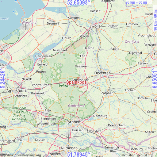
Spainkbos GPS coordinates[2]
52° 13' 20.208" North, 5° 56' 50.568" East
| Map corner | latitude | longitude |
|---|---|---|
| Upper-left | 52.65093°, | 5.24426° |
| Center: | 52.22228°, | 5.94738° |
| Lower-right: | 51.78945°, | 6.65051° |
| Map W x H: | 95.8×95.8 km | = 59.5×59.5mi |
| max Lat: | 53.48025° ⇑37.5% North |
| Spainkbos: | 52.22228° |
| min Lat: | ⇓62.5% South 50.76917° |
| min Long | Spainkbos | max Long |
| 3.38611° | 5.94738° | 7.16528° |
| W 67.6%⇐ | ⇒32.4% E |
Elevation
Elevation of Spainkbos is 20 m = 66 ft, and this is 5 m = 16 ft above average elevation for this country.
| Max E: |
203 m = 666 ft | 21.2% |
| Spainkbos | 20 m 66 ft | |
| Avg. | 15 m = 49 ft | |
Min E: |
-6 m = -20 ft | 78.8% |
See also: Netherlands elevation on elevation.city.
Geographical zone
Spainkbos is located in North temperate zone (between Tropic of Cancer and the Arctic Circle). Distance of this North polar circle is 1594.6 km =990.8 mi to North.| Distance of | km | miles | from Spainkbos |
|---|---|---|---|
| North Pole | 4200.5 | 2610.1 | to North |
| Arctic Circle | 1594.6 | 990.8 | to North |
| Tropic Cancer | 3200.7 | 1988.8 | to South |
| Equator | 5806.6 | 3608.1 | to South |


Nearby cities:
15 places around Spainkbos: (largest is in red/bold)
• Apeldoorn
2 km =1.2 mi,  132°
132°
• Berg en Bos
1 km =0.6 mi,  255°
255°
• Binnenstad
1.3 km =0.8 mi,  141°
141°
• Brinkhorst
1.1 km =0.7 mi,  164°
164°
• Brummelhof
2.4 km =1.5 mi, 143°
• De Haven
2.2 km =1.4 mi, 125°
• Driehuizen
1.5 km =0.9 mi,  187°
187°
• Het Loo
1.3 km =0.8 mi,  15°
15°
• Hommelbrink
2.2 km =1.4 mi,  30°
30°
• Kerschoten
1.8 km =1.1 mi,  46°
46°
• Sluisoord
2.3 km =1.4 mi,  88°
88°
• Sprengenbos
0.5 km =0.3 mi,  227°
227°
• Sprengenweg-Noord
0.5 km =0.3 mi,  152°
152°
• Welgelegen
2.2 km =1.4 mi,  115°
115°
• Zevenhuizen
2.2 km =1.4 mi,  102°
102°
Sources, notices
• [Note1] Compared only with cities in Netherlands existing in our database
• [Src1] Map data: © OpenStreetMap contributors (CC-BY-SA)
• [Src2] Other city data from geonames.org with taken over terms of usage.
• [Src3] Geographical zone / Annual Mean Temperature by Robert A. Rohde @ Wikipedia
