Brummelhof geodata
Brummelhof (Gelderland) is a section of populated place; located in Netherlands in Europe/Amsterdam (GMT+2) time zone. With population of 3,455 people, there are 686 cities with bigger population in this country. Compared to other cities in Netherlands, 60.9% of cities are located further ↓South; 69.8% of cities are located further ←West and 74.9% of cities have lower elevation than Brummelhof. Note1


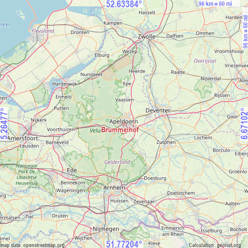
Brummelhof GPS coordinates[2]
52° 12' 18.108" North, 5° 58' 4.404" East
| Map corner | latitude | longitude |
|---|---|---|
| Upper-left | 52.63384°, | 5.26477° |
| Center: | 52.20503°, | 5.96789° |
| Lower-right: | 51.77204°, | 6.67102° |
| Map W x H: | 95.8×95.8 km | = 59.5×59.5mi |
| max Lat: | 53.48025° ⇑39.1% North |
| Brummelhof: | 52.20503° |
| min Lat: | ⇓60.9% South 50.76917° |
| min Long | Brummelhof | max Long |
| 3.38611° | 5.96789° | 7.16528° |
| W 69.8%⇐ | ⇒30.2% E |
Elevation
Elevation of Brummelhof is 18 m = 59 ft, and this is 3 m = 10 ft above average elevation for this country.
| Max E: |
203 m = 666 ft | 25.1% |
| Brummelhof | 18 m 59 ft | |
| Avg. | 15 m = 49 ft | |
Min E: |
-6 m = -20 ft | 74.9% |
See also: Netherlands elevation on elevation.city.
Geographical zone
Brummelhof is located in North temperate zone (between Tropic of Cancer and the Arctic Circle). Distance of this North polar circle is 1596.5 km =992 mi to North.| Distance of | km | miles | from Brummelhof |
|---|---|---|---|
| North Pole | 4202.4 | 2611.2 | to North |
| Arctic Circle | 1596.5 | 992 | to North |
| Tropic Cancer | 3198.7 | 1987.6 | to South |
| Equator | 5804.7 | 3606.9 | to South |


Nearby cities:
15 places around Brummelhof: (largest is in red/bold)
• Apeldoorn
0.6 km =0.4 mi,  10°
10°
• Binnenstad
1.1 km =0.7 mi,  327°
327°
• Brinkhorst
1.4 km =0.9 mi,  308°
308°
• Componistenkwartier
1.7 km =1.1 mi,  184°
184°
• De Haven
0.7 km =0.4 mi,  34°
34°
• De Heeze
1.1 km =0.7 mi,  243°
243°
• Driehuizen
1.7 km =1.1 mi,  284°
284°
• Matendreef
1.4 km =0.9 mi,  114°
114°
• Matenhorst
1.7 km =1.1 mi,  90°
90°
• Staatsliedenkwartier
0.9 km =0.6 mi,  134°
134°
• Vogelkwartier
0.8 km =0.5 mi, 183°
• Welgelegen
1.2 km =0.7 mi, 30°
• Westenenk
1.2 km =0.7 mi,  218°
218°
• Winkewijert
1.7 km =1.1 mi,  203°
203°
• Zevenhuizen
1.6 km =1 mi, 26°
Sources, notices
• [Note1] Compared only with cities in Netherlands existing in our database
• [Src1] Map data: © OpenStreetMap contributors (CC-BY-SA)
• [Src2] Other city data from geonames.org with taken over terms of usage.
• [Src3] Geographical zone / Annual Mean Temperature by Robert A. Rohde @ Wikipedia
