Kirkenes geodata
Kirkenes (Finnmark) is a seat of a second-order administrative division; located in Norway in Europe/Oslo (GMT+2) time zone. With population of 3,282 people, there are 124 cities with bigger population in this country. Compared to other cities in Norway, 96.7% of cities are located further ↓South; 99.8% of cities are located further ←West and 81.6% of cities have higher elevation than Kirkenes. Note1


Kirkenes GPS coordinates[2]
69° 43' 37.416" North, 30° 2' 44.808" East
| Map corner | latitude | longitude |
|---|---|---|
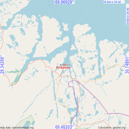
| Upper-left | 69.96929°, | 29.34266° |
| Center: | 69.72706°, | 30.04578° |
| Lower-right: | 69.48203°, | 30.74891° |
| Map W x H: | 54.2×54.2 km | = 33.7×33.7mi |
| max Lat: | 71.04137° ⇑3.3% North |
| Kirkenes: | 69.72706° |
| min Lat: | ⇓96.7% South 58.0274° |
| min Long | Kirkenes | max Long |
| 4.71485° | 30.04578° | 31.11066° |
| W 99.8%⇐ | ⇒0.2% E |
Elevation
Elevation of Kirkenes is 10 m = 33 ft, and this is 94.2 m = 309 ft below average elevation for this country.
| Max E: |
897 m = 2943 ft | 81.6% |
| Avg. | 104.2 m = 342 ft | |
| Kirkenes | 10 m = 33 ft | |
Min E: |
1 m = 3 ft | 18.4% |
See also: Norway elevation on elevation.city.
Geographical zone
Kirkenes is located in North Frigid zone (between North Pole and Arctic Circle). Distance of this North polar circle is 351.7 km =218.5 mi to South.| Distance of | km | miles | from Kirkenes |
|---|---|---|---|
| North Pole | 2254.1 | 1400.6 | to North |
| Arctic Circle | 351.7 | 218.5 | to South |
| Tropic Cancer | 5147 | 3198.2 | to South |
| Equator | 7752.9 | 4817.4 | to South |


Nearby cities:
9 places around Kirkenes: (largest is in red/bold)
• Berlevåg
130.8 km =81.3 mi,  344°
344°
• Bjørnevatn
7 km =4.3 mi,  198°
198°
• Båtsfjord
101.6 km =63.1 mi,  353°
353°
• Kjøllefjord
169 km =105 mi,  323°
323°
• Mehamn
167.5 km =104.1 mi,  330°
330°
• Tana bru
88 km =54.7 mi,  306°
306°
• Vadsø
40.1 km =24.9 mi, 343°
• Vardø
82.2 km =51.1 mi,  29°
29°
• Vuonnabahta
75.4 km =46.9 mi, 311°
Sources, notices
• [Note1] Compared only with cities in Norway existing in our database
• [Src1] Map data: © OpenStreetMap contributors (CC-BY-SA)
• [Src2] Other city data from geonames.org with taken over terms of usage.
• [Src3] Geographical zone / Annual Mean Temperature by Robert A. Rohde @ Wikipedia
