Vuonnabahta geodata
Vuonnabahta (Finnmark) is a seat of a second-order administrative division; located in Norway in Europe/Oslo (GMT+2) time zone. In our database, there are 488 cities with bigger population. Compared to other cities in Norway, 97.9% of cities are located further ↓South; 99.1% of cities are located further ←West and 88.6% of cities have higher elevation than Vuonnabahta. Note1


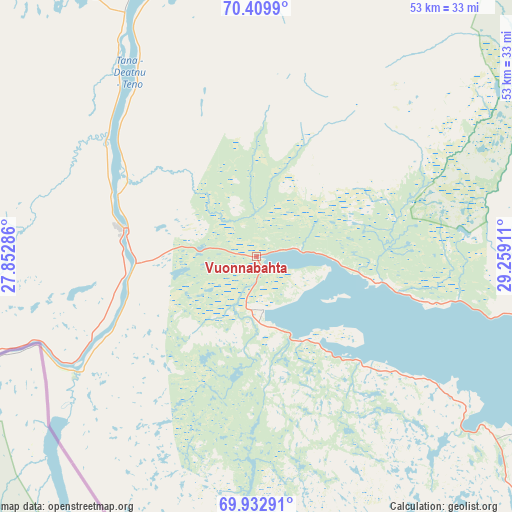
Vuonnabahta GPS coordinates[2]
70° 10' 22.008" North, 28° 33' 21.528" East
| Map corner | latitude | longitude |
|---|---|---|
| Upper-left | 70.4099°, | 27.85286° |
| Center: | 70.17278°, | 28.55598° |
| Lower-right: | 69.93291°, | 29.25911° |
| Map W x H: | 53×53 km | = 32.9×32.9mi |
| max Lat: | 71.04137° ⇑2.1% North |
| Vuonnabahta: | 70.17278° |
| min Lat: | ⇓97.9% South 58.0274° |
| min Long | Vuonnabahta | max Long |
| 4.71485° | 28.55598° | 31.11066° |
| W 99.1%⇐ | ⇒0.90000000000001% E |
Elevation
Elevation of Vuonnabahta is 5 m = 16 ft, and this is 99.2 m = 325 ft below average elevation for this country.
| Max E: |
897 m = 2943 ft | 88.6% |
| Avg. | 104.2 m = 342 ft | |
| Vuonnabahta | 5 m = 16 ft | |
Min E: |
1 m = 3 ft | 11.4% |
See also: Norway elevation on elevation.city.
Geographical zone
Vuonnabahta is located in North Frigid zone (between North Pole and Arctic Circle). Distance of this North polar circle is 401.3 km =249.4 mi to South.| Distance of | km | miles | from Vuonnabahta |
|---|---|---|---|
| North Pole | 2204.6 | 1369.9 | to North |
| Arctic Circle | 401.3 | 249.4 | to South |
| Tropic Cancer | 5196.6 | 3229 | to South |
| Equator | 7802.5 | 4848.2 | to South |


Nearby cities:
13 places around Vuonnabahta: (largest is in red/bold)
• Berlevåg
78.7 km =48.9 mi,  14°
14°
• Bjørnevatn
78.4 km =48.7 mi,  135°
135°
• Båtsfjord
67.1 km =41.7 mi,  40°
40°
• Honningsvåg
131.3 km =81.6 mi,  313°
313°
• Kirkenes
75.4 km =46.9 mi,  131°
131°
• Kjøllefjord
96.9 km =60.2 mi,  332°
332°
• Kárášjohka
140.4 km =87.2 mi,  236°
236°
• Lakselv
136.2 km =84.6 mi,  264°
264°
• Mehamn
100 km =62.1 mi,  344°
344°
• Tana bru
14.1 km =8.8 mi,  281°
281°
• Vadsø
46.4 km =28.8 mi,  103°
103°
• Vardø
98.4 km =61.1 mi,  77°
77°
• Ávanuorri
170.5 km =105.9 mi,  302°
302°
Sources, notices
• [Note1] Compared only with cities in Norway existing in our database
• [Src1] Map data: © OpenStreetMap contributors (CC-BY-SA)
• [Src2] Other city data from geonames.org with taken over terms of usage.
• [Src3] Geographical zone / Annual Mean Temperature by Robert A. Rohde @ Wikipedia
