Manukau City geodata
Manukau City (Auckland) is a populated place; located in New Zealand in Pacific/Auckland (GMT+12) time zone. With population of 362,000 people, there are 3 cities with bigger population in this country. Compared to other cities in New Zealand, 81.6% of cities are located further ↓South; 61.8% of cities are located further ←West and 57% of cities have lower elevation than Manukau City. Note1


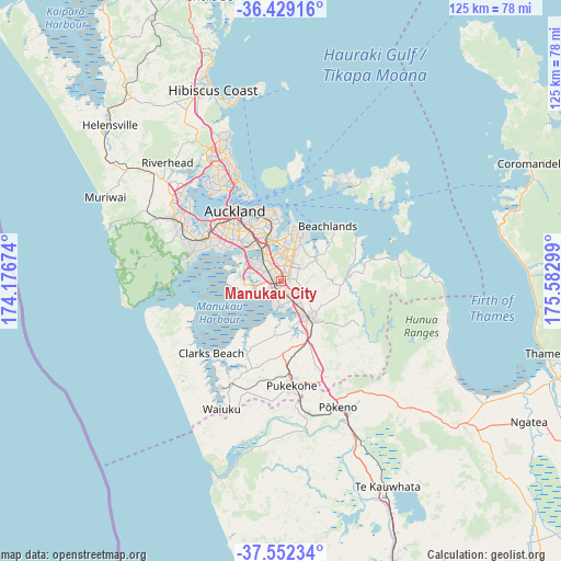
Manukau City GPS coordinates[2]
36° 59' 34.152" South, 174° 52' 47.496" East
| Map corner | latitude | longitude |
|---|---|---|
| Upper-left | -36.42916°, | 174.17674° |
| Center: | -36.99282°, | 174.87986° |
| Lower-right: | -37.55234°, | 175.58299° |
| Map W x H: | 124.9×124.9 km | = 77.6×77.6mi |
| max Lat: | -34.99604° ⇑18.4% North |
| Manukau City: | -36.99282° |
| min Lat: | ⇓81.6% South -46.6° |
| min Long | Manukau City | max Long |
| -176.55973° | 174.87986° | 178.33333° |
| W 61.8%⇐ | ⇒38.2% E |
Elevation
Elevation of Manukau City is 43 m = 141 ft, and this is 41.4 m = 136 ft below average elevation for this country.
| Max E: |
819 m = 2687 ft | 43% |
| Avg. | 84.4 m = 277 ft | |
| Manukau City | 43 m = 141 ft | |
Min E: |
3 m = 10 ft | 57% |
See also: Manukau City elevation on elevation.city.
Geographical zone
Manukau City is located in South temperate zone (between Tropic of Capricorn and the Antarctic Circle). Distance of this Southern Tropic circle is 1507.3 km =936.6 mi to North.| Distance of | km | miles | from Manukau City |
|---|---|---|---|
| Equator | 4113.2 | 2555.8 | to North |
| Tropic Capricorn | 1507.3 | 936.6 | to North |
| Antarctic Circle | 3288 | 2043.1 | to South |
| South Pole | 5893.8 | 3662.2 | to South |


Nearby cities:
15 places around Manukau City: (largest is in red/bold)
• Auckland
19.1 km =11.9 mi,  327°
327°
• Bombay
21.4 km =13.3 mi,  154°
154°
• East Tamaki
5.1 km =3.2 mi,  20°
20°
• Mangere
7.7 km =4.8 mi,  290°
290°
• North Shore
24.4 km =15.2 mi, 331°
• Pakuranga
12.6 km =7.8 mi, 15°
• Papakura
9.9 km =6.2 mi,  144°
144°
• Pukekohe East
23.9 km =14.9 mi,  164°
164°
• Red Hill
10.8 km =6.7 mi,  132°
132°
• Rosebank
22.8 km =14.2 mi,  305°
305°
• Takanini
6.4 km =4 mi, 163°
• Tamaki
11.8 km =7.3 mi,  351°
351°
• Titirangi
20.8 km =12.9 mi, 287°
• Waitakere
21.4 km =13.3 mi, 292°
• Wiri
1.8 km =1.1 mi,  251°
251°
Sources, notices
• [Note1] Compared only with cities in New Zealand existing in our database
• [Src1] Map data: © OpenStreetMap contributors (CC-BY-SA)
• [Src2] Other city data from geonames.org with taken over terms of usage.
• [Src3] Geographical zone / Annual Mean Temperature by Robert A. Rohde @ Wikipedia
