Lajas geodata
Lajas (Cajamarca) is a seat of a third-order administrative division; located in Peru in America/Lima (GMT-5) time zone. In our database, there are 305 cities with bigger population. Compared to other cities in Peru, 83.9% of cities are located further ↓South; 87.9% of cities are located further →East and 63.2% of cities have higher elevation than Lajas. Note1


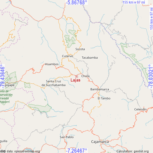
Lajas GPS coordinates[2]
6° 34' 0.012" South, 78° 43' 59.988" West
| Map corner | latitude | longitude |
|---|---|---|
| Upper-left | -5.86768°, | -79.43646° |
| Center: | -6.56667°, | -78.73333° |
| Lower-right: | -7.26467°, | -78.03021° |
| Map W x H: | 155.3×155.3 km | = 96.5×96.5mi |
| max Lat: | -0.96667° ⇑16.1% North |
| Lajas: | -6.56667° |
| min Lat: | ⇓83.9% South -18.01465° |
| min Long | Lajas | max Long |
| -81.30472° | -78.73333° | -69.04167° |
| W 12.1%⇐ | ⇒87.9% E |
Elevation
Elevation of Lajas is 2213 m = 7260 ft, and this is 105.7 m = 347 ft below average elevation for this country.
| Max E: |
5022 m = 16476 ft | 63.2% |
| Avg. | 2318.7 m = 7607 ft | |
| Lajas | 2213 m = 7260 ft | |
Min E: |
1 m = 3 ft | 36.8% |
See also: Peru elevation on elevation.city.
Geographical zone
Lajas is located in South Torrid zone (between Equator and Tropic of Capricorn). Distance of Equator is 730.1 km =453.7 mi to North.| Distance of | km | miles | from Lajas |
|---|---|---|---|
| Equator | 730.1 | 453.7 | to North |
| Tropic Capricorn | 1875.8 | 1165.6 | to South |
| Antarctic Circle | 6671 | 4145.2 | to South |
| South Pole | 9276.9 | 5764.4 | to South |


Nearby cities:
15 places around Lajas: (largest is in red/bold)
• Bambamarca
25.6 km =15.9 mi,  120°
120°
• Catache
35.2 km =21.9 mi,  249°
249°
• Chalamarca
30.4 km =18.9 mi,  74°
74°
• Chiguirip
16.7 km =10.4 mi,  0°
0°
• Chota
9.4 km =5.8 mi,  78°
78°
• Chugur
11.3 km =7 mi,  189°
189°
• Cochabamba
20.6 km =12.8 mi,  296°
296°
• Cutervo
25.7 km =16 mi,  329°
329°
• Hualgayoc
25.7 km =16 mi,  149°
149°
• Huambos
28.1 km =17.5 mi,  293°
293°
• Paccha
35.6 km =22.1 mi, 77°
• Sexi
35.1 km =21.8 mi,  270°
270°
• Socota
29.7 km =18.5 mi, 0°
• Tacabamba
24.1 km =15 mi,  32°
32°
• Uticyacu
10.4 km =6.5 mi,  224°
224°
Sources, notices
• [Note1] Compared only with cities in Peru existing in our database
• [Src1] Map data: © OpenStreetMap contributors (CC-BY-SA)
• [Src2] Other city data from geonames.org with taken over terms of usage.
• [Src3] Geographical zone / Annual Mean Temperature by Robert A. Rohde @ Wikipedia
