Carhuaz geodata
Carhuaz (Ancash) is a seat of a third-order administrative division; located in Peru in America/Lima (GMT-5) time zone. With population of 5,044 people, there are 234 cities with bigger population in this country. Compared to other cities in Peru, 66.4% of cities are located further ↓South; 75.2% of cities are located further →East and 56% of cities have higher elevation than Carhuaz. Note1


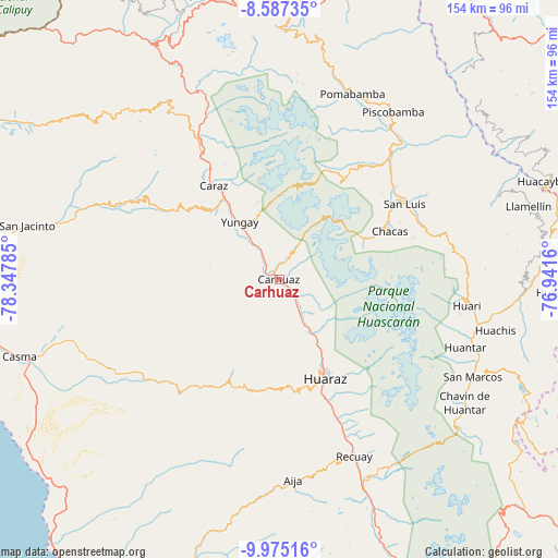
Carhuaz GPS coordinates[2]
9° 16' 54.984" South, 77° 38' 40.992" West
| Map corner | latitude | longitude |
|---|---|---|
| Upper-left | -8.58735°, | -78.34785° |
| Center: | -9.28194°, | -77.64472° |
| Lower-right: | -9.97516°, | -76.9416° |
| Map W x H: | 154.3×154.3 km | = 95.9×95.9mi |
| max Lat: | -0.96667° ⇑33.6% North |
| Carhuaz: | -9.28194° |
| min Lat: | ⇓66.4% South -18.01465° |
| min Long | Carhuaz | max Long |
| -81.30472° | -77.64472° | -69.04167° |
| W 24.8%⇐ | ⇒75.2% E |
Elevation
Elevation of Carhuaz is 2650 m = 8694 ft, and this is 331.3 m = 1087 ft above average elevation for this country.
| Max E: |
5022 m = 16476 ft | 56% |
| Carhuaz | 2650 m 8694 ft | |
| Avg. | 2318.7 m = 7607 ft | |
Min E: |
1 m = 3 ft | 44% |
See also: Peru elevation on elevation.city.
Geographical zone
Carhuaz is located in South Torrid zone (between Equator and Tropic of Capricorn). Distance of Equator is 1032.1 km =641.3 mi to North.| Distance of | km | miles | from Carhuaz |
|---|---|---|---|
| Equator | 1032.1 | 641.3 | to North |
| Tropic Capricorn | 1573.9 | 978 | to South |
| Antarctic Circle | 6369.1 | 3957.6 | to South |
| South Pole | 8975 | 5576.8 | to South |


Nearby cities:
15 places around Carhuaz: (largest is in red/bold)
• Aco
13.2 km =8.2 mi,  137°
137°
• Acopampa
3.4 km =2.1 mi,  119°
119°
• Amashca
4.8 km =3 mi,  357°
357°
• Anta
10 km =6.2 mi,  148°
148°
• Carhuac
5.7 km =3.5 mi,  293°
293°
• Cascapara
10 km =6.2 mi,  308°
308°
• Jangas
15.4 km =9.6 mi, 150°
• Mancos
12.6 km =7.8 mi,  323°
323°
• Marcara District
6.4 km =4 mi,  134°
134°
• Ranrahirca
14.9 km =9.3 mi,  325°
325°
• Shilla
6.1 km =3.8 mi,  20°
20°
• Shupluy
9 km =5.6 mi, 322°
• Tarica
14.6 km =9.1 mi, 148°
• Tinco
4 km =2.5 mi, 289°
• Yungar
12.1 km =7.5 mi, 151°
Sources, notices
• [Note1] Compared only with cities in Peru existing in our database
• [Src1] Map data: © OpenStreetMap contributors (CC-BY-SA)
• [Src2] Other city data from geonames.org with taken over terms of usage.
• [Src3] Geographical zone / Annual Mean Temperature by Robert A. Rohde @ Wikipedia
