Aco geodata
Aco (Ancash) is a seat of a third-order administrative division; located in Peru in America/Lima (GMT-5) time zone. In our database, there are 305 cities with bigger population. Compared to other cities in Peru, 65.7% of cities are located further ↓South; 73.5% of cities are located further →East and 53.6% of cities have lower elevation than Aco. Note1
Administrative division(s):
- Level 1: Ancash
- Level 2: Provincia de Carhuaz
- Level 3: San Miguel De Aco


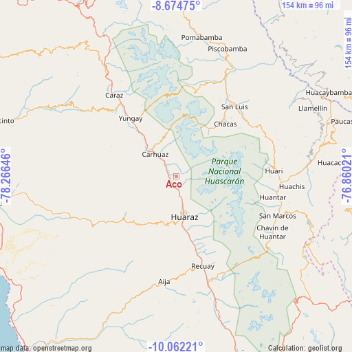
Aco GPS coordinates[2]
9° 22' 9.012" South, 77° 33' 47.988" West
| Map corner | latitude | longitude |
|---|---|---|
| Upper-left | -8.67475°, | -78.26646° |
| Center: | -9.36917°, | -77.56333° |
| Lower-right: | -10.06221°, | -76.86021° |
| Map W x H: | 154.3×154.3 km | = 95.9×95.9mi |
| max Lat: | -0.96667° ⇑34.3% North |
| Aco: | -9.36917° |
| min Lat: | ⇓65.7% South -18.01465° |
| min Long | Aco | max Long |
| -81.30472° | -77.56333° | -69.04167° |
| W 26.5%⇐ | ⇒73.5% E |
Elevation
Elevation of Aco is 2990 m = 9810 ft, and this is 671.3 m = 2202 ft above average elevation for this country.
| Max E: |
5022 m = 16476 ft | 46.4% |
| Aco | 2990 m 9810 ft | |
| Avg. | 2318.7 m = 7607 ft | |
Min E: |
1 m = 3 ft | 53.6% |
See also: Peru elevation on elevation.city.
Geographical zone
Aco is located in South Torrid zone (between Equator and Tropic of Capricorn). Distance of Equator is 1041.8 km =647.3 mi to North.| Distance of | km | miles | from Aco |
|---|---|---|---|
| Equator | 1041.8 | 647.3 | to North |
| Tropic Capricorn | 1564.2 | 971.9 | to South |
| Antarctic Circle | 6359.4 | 3951.5 | to South |
| South Pole | 8965.3 | 5570.8 | to South |


Nearby cities:
15 places around Aco: (largest is in red/bold)
• Acopampa
10 km =6.2 mi,  323°
323°
• Amashca
17.1 km =10.6 mi,  327°
327°
• Anta
3.9 km =2.4 mi,  287°
287°
• Carhuac
18.6 km =11.6 mi,  310°
310°
• Carhuaz
13.2 km =8.2 mi, 317°
• Cascapara
23.2 km =14.4 mi, 313°
• Chacas
24.9 km =15.5 mi,  52°
52°
• Huaraz
18.1 km =11.2 mi,  167°
167°
• Jangas
4 km =2.5 mi,  200°
200°
• Marcara District
6.8 km =4.2 mi, 319°
• Shilla
16.8 km =10.4 mi,  336°
336°
• Shupluy
22.1 km =13.7 mi, 319°
• Tarica
3 km =1.9 mi, 204°
• Tinco
16.9 km =10.5 mi, 310°
• Yungar
3.4 km =2.1 mi,  253°
253°
Sources, notices
• [Note1] Compared only with cities in Peru existing in our database
• [Src1] Map data: © OpenStreetMap contributors (CC-BY-SA)
• [Src2] Other city data from geonames.org with taken over terms of usage.
• [Src3] Geographical zone / Annual Mean Temperature by Robert A. Rohde @ Wikipedia
