Bellavista geodata
Bellavista (Cajamarca) is a seat of a third-order administrative division; located in Peru in America/Lima (GMT-5) time zone. With population of 6,320 people, there are 201 cities with bigger population in this country. Compared to other cities in Peru, 92.2% of cities are located further ↓South; 87.4% of cities are located further →East and 78.6% of cities have higher elevation than Bellavista. Note1


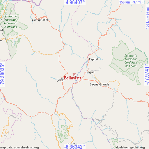
Bellavista GPS coordinates[2]
5° 39' 51.012" South, 78° 40' 37.992" West
| Map corner | latitude | longitude |
|---|---|---|
| Upper-left | -4.96407°, | -79.38035° |
| Center: | -5.66417°, | -78.67722° |
| Lower-right: | -6.36342°, | -77.9741° |
| Map W x H: | 155.6×155.6 km | = 96.7×96.7mi |
| max Lat: | -0.96667° ⇑7.8% North |
| Bellavista: | -5.66417° |
| min Lat: | ⇓92.2% South -18.01465° |
| min Long | Bellavista | max Long |
| -81.30472° | -78.67722° | -69.04167° |
| W 12.6%⇐ | ⇒87.4% E |
Elevation
Elevation of Bellavista is 437 m = 1434 ft, and this is 1881.7 m = 6174 ft below average elevation for this country.
| Max E: |
5022 m = 16476 ft | 78.6% |
| Avg. | 2318.7 m = 7607 ft | |
| Bellavista | 437 m = 1434 ft | |
Min E: |
1 m = 3 ft | 21.4% |
See also: Peru elevation on elevation.city.
Geographical zone
Bellavista is located in South Torrid zone (between Equator and Tropic of Capricorn). Distance of Equator is 629.8 km =391.3 mi to North.| Distance of | km | miles | from Bellavista |
|---|---|---|---|
| Equator | 629.8 | 391.3 | to North |
| Tropic Capricorn | 1976.1 | 1227.9 | to South |
| Antarctic Circle | 6771.4 | 4207.6 | to South |
| South Pole | 9377.3 | 5826.8 | to South |


Nearby cities:
15 places around Bellavista: (largest is in red/bold)
• Aramango
38.4 km =23.9 mi,  44°
44°
• Bagua
16.2 km =10.1 mi,  77°
77°
• Bagua Grande
28.1 km =17.5 mi,  111°
111°
• Cajaruro
29 km =18 mi, 106°
• Chirinos
46.8 km =29.1 mi,  328°
328°
• Choros
26.4 km =16.4 mi,  184°
184°
• Cumba
29.9 km =18.6 mi, 176°
• El Parco District
22.7 km =14.1 mi, 78°
• Huabal
27.8 km =17.3 mi,  281°
281°
• Jamalca
51.2 km =31.8 mi,  116°
116°
• Jaén
15.2 km =9.4 mi,  251°
251°
• La Coipa
32.9 km =20.4 mi,  321°
321°
• La Peca
27.4 km =17 mi, 77°
• La Sacilia
32.4 km =20.1 mi,  189°
189°
• Las Pirias
19.9 km =12.4 mi, 281°
Sources, notices
• [Note1] Compared only with cities in Peru existing in our database
• [Src1] Map data: © OpenStreetMap contributors (CC-BY-SA)
• [Src2] Other city data from geonames.org with taken over terms of usage.
• [Src3] Geographical zone / Annual Mean Temperature by Robert A. Rohde @ Wikipedia
