Quebrada Honda geodata
Quebrada Honda (Cusco) is a seat of a third-order administrative division; located in Peru in America/Lima (GMT-5) time zone. In our database, there are 305 cities with bigger population. Compared to other cities in Peru, 59.1% of cities are located further ↑North; 78.8% of cities are located further ←West and 59.7% of cities have higher elevation than Quebrada Honda. Note1


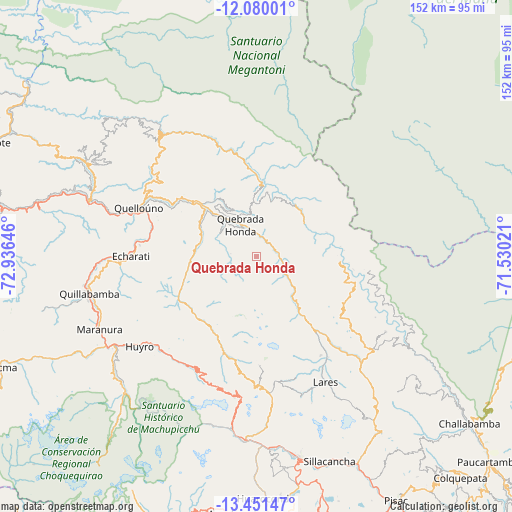
Quebrada Honda GPS coordinates[2]
12° 46' 0.012" South, 72° 13' 59.988" West
| Map corner | latitude | longitude |
|---|---|---|
| Upper-left | -12.08001°, | -72.93646° |
| Center: | -12.76667°, | -72.23333° |
| Lower-right: | -13.45147°, | -71.53021° |
| Map W x H: | 152.5×152.5 km | = 94.8×94.8mi |
| max Lat: | -0.96667° ⇑59.1% North |
| Quebrada Honda: | -12.76667° |
| min Lat: | ⇓40.9% South -18.01465° |
| min Long | Quebrada Honda | max Long |
| -81.30472° | -72.23333° | -69.04167° |
| W 78.8%⇐ | ⇒21.2% E |
Elevation
Elevation of Quebrada Honda is 2449 m = 8035 ft, and this is 130.3 m = 427 ft above average elevation for this country.
| Max E: |
5022 m = 16476 ft | 59.7% |
| Quebrada Honda | 2449 m 8035 ft | |
| Avg. | 2318.7 m = 7607 ft | |
Min E: |
1 m = 3 ft | 40.3% |
See also: Peru elevation on elevation.city.
Geographical zone
Quebrada Honda is located in South Torrid zone (between Equator and Tropic of Capricorn). Distance of this Southern Tropic circle is 1186.4 km =737.2 mi to South.| Distance of | km | miles | from Quebrada Honda |
|---|---|---|---|
| Equator | 1419.5 | 882 | to North |
| Tropic Capricorn | 1186.4 | 737.2 | to South |
| Antarctic Circle | 5981.7 | 3716.9 | to South |
| South Pole | 8587.5 | 5336 | to South |


Nearby cities:
15 places around Quebrada Honda: (largest is in red/bold)
• Calca
70.1 km =43.6 mi,  154°
154°
• Chinchero
72.4 km =45 mi,  163°
163°
• Echarate
41.6 km =25.8 mi,  274°
274°
• Huarocondo
72 km =44.7 mi,  177°
177°
• Huayllabamba
66.1 km =41.1 mi, 164°
• Lares
42.7 km =26.5 mi, 151°
• Maranura
51.6 km =32.1 mi,  244°
244°
• Maras
63.7 km =39.6 mi,  172°
172°
• Ollantaytambo
54.6 km =33.9 mi, 183°
• Quellouno
38.2 km =23.7 mi,  292°
292°
• Quillabamba
51 km =31.7 mi,  257°
257°
• Santa Ana
53.6 km =33.3 mi, 258°
• Santa Teresa
56.1 km =34.9 mi,  223°
223°
• Urubamba
61.2 km =38 mi, 167°
• Yucay
63.8 km =39.6 mi, 165°
Sources, notices
• [Note1] Compared only with cities in Peru existing in our database
• [Src1] Map data: © OpenStreetMap contributors (CC-BY-SA)
• [Src2] Other city data from geonames.org with taken over terms of usage.
• [Src3] Geographical zone / Annual Mean Temperature by Robert A. Rohde @ Wikipedia
