Quellouno geodata
Quellouno (Cusco) is a seat of a third-order administrative division; located in Peru in America/Lima (GMT-5) time zone. In our database, there are 305 cities with bigger population. Compared to other cities in Peru, 58.3% of cities are located further ↑North; 77.2% of cities are located further ←West and 74.8% of cities have higher elevation than Quellouno. Note1


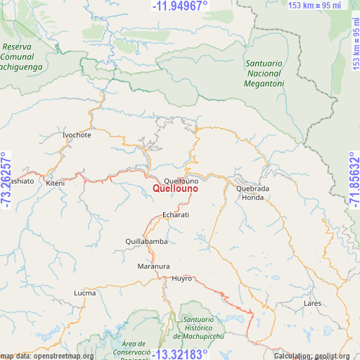
Quellouno GPS coordinates[2]
12° 38' 12.012" South, 72° 33' 33.984" West
| Map corner | latitude | longitude |
|---|---|---|
| Upper-left | -11.94967°, | -73.26257° |
| Center: | -12.63667°, | -72.55944° |
| Lower-right: | -13.32183°, | -71.85632° |
| Map W x H: | 152.6×152.6 km | = 94.8×94.8mi |
| max Lat: | -0.96667° ⇑58.3% North |
| Quellouno: | -12.63667° |
| min Lat: | ⇓41.7% South -18.01465° |
| min Long | Quellouno | max Long |
| -81.30472° | -72.55944° | -69.04167° |
| W 77.2%⇐ | ⇒22.8% E |
Elevation
Elevation of Quellouno is 765 m = 2510 ft, and this is 1553.7 m = 5097 ft below average elevation for this country.
| Max E: |
5022 m = 16476 ft | 74.8% |
| Avg. | 2318.7 m = 7607 ft | |
| Quellouno | 765 m = 2510 ft | |
Min E: |
1 m = 3 ft | 25.2% |
See also: Peru elevation on elevation.city.
Geographical zone
Quellouno is located in South Torrid zone (between Equator and Tropic of Capricorn). Distance of this Southern Tropic circle is 1200.9 km =746.2 mi to South.| Distance of | km | miles | from Quellouno |
|---|---|---|---|
| Equator | 1405.1 | 873.1 | to North |
| Tropic Capricorn | 1200.9 | 746.2 | to South |
| Antarctic Circle | 5996.1 | 3725.8 | to South |
| South Pole | 8602 | 5345 | to South |


Nearby cities:
15 places around Quellouno: (largest is in red/bold)
• Ancahuasi
93.6 km =58.2 mi,  163°
163°
• Echarate
12.5 km =7.8 mi,  209°
209°
• Huarocondo
94.4 km =58.7 mi, 156°
• Lares
76.3 km =47.4 mi,  132°
132°
• Limatambo
94.5 km =58.7 mi,  172°
172°
• Maranura
38 km =23.6 mi,  197°
197°
• Maras
89.1 km =55.4 mi,  150°
150°
• Ollantaytambo
76.1 km =47.3 mi, 155°
• Pangoa
75 km =46.6 mi,  320°
320°
• Quebrada Honda
38.2 km =23.7 mi,  112°
112°
• Quillabamba
29.1 km =18.1 mi, 209°
• Santa Ana
30.7 km =19.1 mi, 213°
• Santa Teresa
55.2 km =34.3 mi,  183°
183°
• Urubamba
88.5 km =55 mi, 147°
• Yucay
92 km =57.2 mi, 145°
Sources, notices
• [Note1] Compared only with cities in Peru existing in our database
• [Src1] Map data: © OpenStreetMap contributors (CC-BY-SA)
• [Src2] Other city data from geonames.org with taken over terms of usage.
• [Src3] Geographical zone / Annual Mean Temperature by Robert A. Rohde @ Wikipedia
