Ocoruro geodata
Ocoruro (Cusco) is a seat of a third-order administrative division; located in Peru in America/Lima (GMT-5) time zone. In our database, there are 305 cities with bigger population. Compared to other cities in Peru, 85.7% of cities are located further ↑North; 89.5% of cities are located further ←West and 95.9% of cities have lower elevation than Ocoruro. Note1


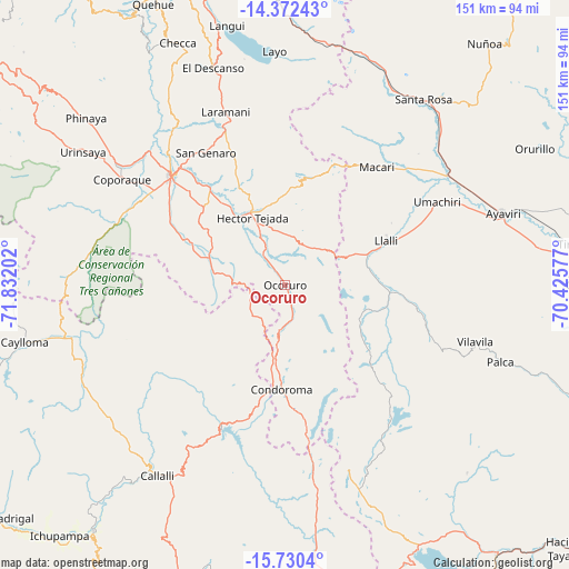
Ocoruro GPS coordinates[2]
15° 3' 9" South, 71° 7' 44.004" West
| Map corner | latitude | longitude |
|---|---|---|
| Upper-left | -14.37243°, | -71.83202° |
| Center: | -15.0525°, | -71.12889° |
| Lower-right: | -15.7304°, | -70.42577° |
| Map W x H: | 151×151 km | = 93.8×93.8mi |
| max Lat: | -0.96667° ⇑85.7% North |
| Ocoruro: | -15.0525° |
| min Lat: | ⇓14.3% South -18.01465° |
| min Long | Ocoruro | max Long |
| -81.30472° | -71.12889° | -69.04167° |
| W 89.5%⇐ | ⇒10.5% E |
Elevation
Elevation of Ocoruro is 4102 m = 13458 ft, and this is 1783.3 m = 5851 ft above average elevation for this country.
| Max E: |
5022 m = 16476 ft | 4.1% |
| Ocoruro | 4102 m 13458 ft | |
| Avg. | 2318.7 m = 7607 ft | |
Min E: |
1 m = 3 ft | 95.9% |
See also: Peru elevation on elevation.city.
Geographical zone
Ocoruro is located in South Torrid zone (between Equator and Tropic of Capricorn). Distance of this Southern Tropic circle is 932.2 km =579.2 mi to South.| Distance of | km | miles | from Ocoruro |
|---|---|---|---|
| Equator | 1673.7 | 1040 | to North |
| Tropic Capricorn | 932.2 | 579.2 | to South |
| Antarctic Circle | 5727.5 | 3558.9 | to South |
| South Pole | 8333.4 | 5178.1 | to South |


Nearby cities:
15 places around Ocoruro: (largest is in red/bold)
• Accocunca
34.2 km =21.3 mi,  336°
336°
• Condoroma
21.4 km =13.3 mi,  166°
166°
• Coporaque
51.7 km =32.1 mi,  302°
302°
• Cupi
31.8 km =19.8 mi,  59°
59°
• El Descanso
60.8 km =37.8 mi, 341°
• Jayune
59.7 km =37.1 mi,  198°
198°
• Llalli
29.6 km =18.4 mi, 63°
• Macari
39.9 km =24.8 mi,  37°
37°
• Ocuviri
24.6 km =15.3 mi,  105°
105°
• Palca
60.5 km =37.6 mi, 109°
• Pichigua
51.6 km =32.1 mi,  323°
323°
• Sibayo
59.9 km =37.2 mi,  216°
216°
• Tisco
47.3 km =29.4 mi,  226°
226°
• Umachiri
45.5 km =28.3 mi, 61°
• Vilavila
52.5 km =32.6 mi, 106°
Sources, notices
• [Note1] Compared only with cities in Peru existing in our database
• [Src1] Map data: © OpenStreetMap contributors (CC-BY-SA)
• [Src2] Other city data from geonames.org with taken over terms of usage.
• [Src3] Geographical zone / Annual Mean Temperature by Robert A. Rohde @ Wikipedia
