Umachiri geodata
Umachiri (Puno) is a seat of a third-order administrative division; located in Peru in America/Lima (GMT-5) time zone. In our database, there are 305 cities with bigger population. Compared to other cities in Peru, 84.6% of cities are located further ↑North; 91.2% of cities are located further ←West and 92.6% of cities have lower elevation than Umachiri. Note1


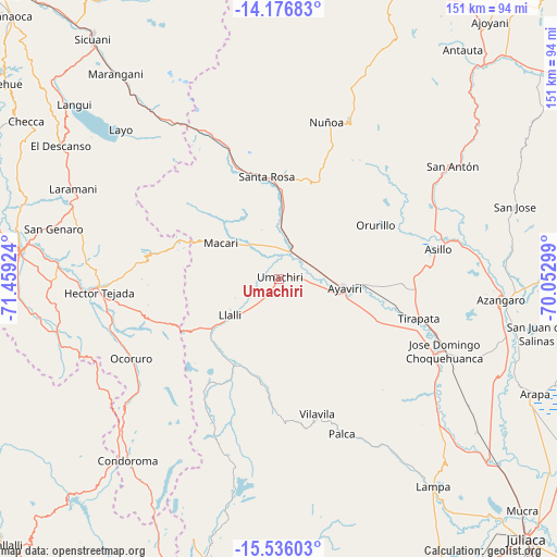
Umachiri GPS coordinates[2]
14° 51' 27" South, 70° 45' 21.996" West
| Map corner | latitude | longitude |
|---|---|---|
| Upper-left | -14.17683°, | -71.45924° |
| Center: | -14.8575°, | -70.75611° |
| Lower-right: | -15.53603°, | -70.05299° |
| Map W x H: | 151.1×151.1 km | = 93.9×93.9mi |
| max Lat: | -0.96667° ⇑84.6% North |
| Umachiri: | -14.8575° |
| min Lat: | ⇓15.4% South -18.01465° |
| min Long | Umachiri | max Long |
| -81.30472° | -70.75611° | -69.04167° |
| W 91.2%⇐ | ⇒8.8% E |
Elevation
Elevation of Umachiri is 3924 m = 12874 ft, and this is 1605.3 m = 5267 ft above average elevation for this country.
| Max E: |
5022 m = 16476 ft | 7.4% |
| Umachiri | 3924 m 12874 ft | |
| Avg. | 2318.7 m = 7607 ft | |
Min E: |
1 m = 3 ft | 92.6% |
See also: Peru elevation on elevation.city.
Geographical zone
Umachiri is located in South Torrid zone (between Equator and Tropic of Capricorn). Distance of this Southern Tropic circle is 953.9 km =592.7 mi to South.| Distance of | km | miles | from Umachiri |
|---|---|---|---|
| Equator | 1652 | 1026.5 | to North |
| Tropic Capricorn | 953.9 | 592.7 | to South |
| Antarctic Circle | 5749.2 | 3572.4 | to South |
| South Pole | 8355.1 | 5191.6 | to South |


Nearby cities:
15 places around Umachiri: (largest is in red/bold)
• Accocunca
54.4 km =33.8 mi,  280°
280°
• Asillo
44.4 km =27.6 mi,  79°
79°
• Ayaviri
18.3 km =11.4 mi,  100°
100°
• Condoroma
55.1 km =34.2 mi,  219°
219°
• Cupi
13.8 km =8.6 mi,  246°
246°
• Llalli
16 km =9.9 mi,  238°
238°
• Macari
18.5 km =11.5 mi,  302°
302°
• Ocoruro
45.5 km =28.3 mi, 241°
• Ocuviri
32.6 km =20.3 mi,  210°
210°
• Orurillo
29.7 km =18.5 mi,  61°
61°
• Palca
45.2 km =28.1 mi,  157°
157°
• Santa Rosa
27.6 km =17.1 mi,  353°
353°
• Tirapata
39.6 km =24.6 mi,  105°
105°
• Vilavila
38.1 km =23.7 mi, 164°
• Ñuñoa
44.1 km =27.4 mi,  17°
17°
Sources, notices
• [Note1] Compared only with cities in Peru existing in our database
• [Src1] Map data: © OpenStreetMap contributors (CC-BY-SA)
• [Src2] Other city data from geonames.org with taken over terms of usage.
• [Src3] Geographical zone / Annual Mean Temperature by Robert A. Rohde @ Wikipedia
