Condoroma geodata
Condoroma (Cusco) is a seat of a third-order administrative division; located in Peru in America/Lima (GMT-5) time zone. In our database, there are 305 cities with bigger population. Compared to other cities in Peru, 87.4% of cities are located further ↑North; 89.7% of cities are located further ←West and 99.9% of cities have lower elevation than Condoroma. Note1


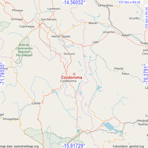
Condoroma GPS coordinates[2]
15° 14' 24" South, 71° 4' 55.992" West
| Map corner | latitude | longitude |
|---|---|---|
| Upper-left | -14.56052°, | -71.78535° |
| Center: | -15.24°, | -71.08222° |
| Lower-right: | -15.91729°, | -70.3791° |
| Map W x H: | 150.9×150.9 km | = 93.8×93.8mi |
| max Lat: | -0.96667° ⇑87.4% North |
| Condoroma: | -15.24° |
| min Lat: | ⇓12.6% South -18.01465° |
| min Long | Condoroma | max Long |
| -81.30472° | -71.08222° | -69.04167° |
| W 89.7%⇐ | ⇒10.3% E |
Elevation
Elevation of Condoroma is 4803 m = 15758 ft, and this is 2484.3 m = 8151 ft above average elevation for this country.
| Max E: |
5022 m = 16476 ft | 0.099999999999994% |
| Condoroma | 4803 m 15758 ft | |
| Avg. | 2318.7 m = 7607 ft | |
Min E: |
1 m = 3 ft | 99.9% |
See also: Peru elevation on elevation.city.
Geographical zone
Condoroma is located in South Torrid zone (between Equator and Tropic of Capricorn). Distance of this Southern Tropic circle is 911.4 km =566.3 mi to South.| Distance of | km | miles | from Condoroma |
|---|---|---|---|
| Equator | 1694.5 | 1052.9 | to North |
| Tropic Capricorn | 911.4 | 566.3 | to South |
| Antarctic Circle | 5706.6 | 3545.9 | to South |
| South Pole | 8312.5 | 5165.1 | to South |


Nearby cities:
15 places around Condoroma: (largest is in red/bold)
• Accocunca
55.5 km =34.5 mi,  340°
340°
• Callalli
49.1 km =30.5 mi,  232°
232°
• Ccolo
53 km =32.9 mi,  236°
236°
• Cupi
43.3 km =26.9 mi,  31°
31°
• Huarichancara
44.5 km =27.7 mi,  177°
177°
• Jayune
43 km =26.7 mi,  213°
213°
• Llalli
40.3 km =25 mi, 32°
• Llongasora
50.1 km =31.1 mi, 207°
• Ocoruro
21.4 km =13.3 mi,  346°
346°
• Ocuviri
23.6 km =14.7 mi,  52°
52°
• Palca
52 km =32.3 mi,  89°
89°
• Sibayo
48.8 km =30.3 mi, 235°
• Tisco
40.9 km =25.4 mi,  253°
253°
• Umachiri
55.1 km =34.2 mi,  39°
39°
• Vilavila
45.7 km =28.4 mi,  82°
82°
Sources, notices
• [Note1] Compared only with cities in Peru existing in our database
• [Src1] Map data: © OpenStreetMap contributors (CC-BY-SA)
• [Src2] Other city data from geonames.org with taken over terms of usage.
• [Src3] Geographical zone / Annual Mean Temperature by Robert A. Rohde @ Wikipedia
