Churcampa geodata
Churcampa (Huancavelica) is a seat of a third-order administrative division; located in Peru in America/Lima (GMT-5) time zone. In our database, there are 305 cities with bigger population. Compared to other cities in Peru, 58.7% of cities are located further ↑North; 62.5% of cities are located further ←West and 90.1% of cities have lower elevation than Churcampa. Note1
Administrative division(s):
- Level 1: Huancavelica
- Level 2: Provincia de Churcampa
- Level 3: Churcampa


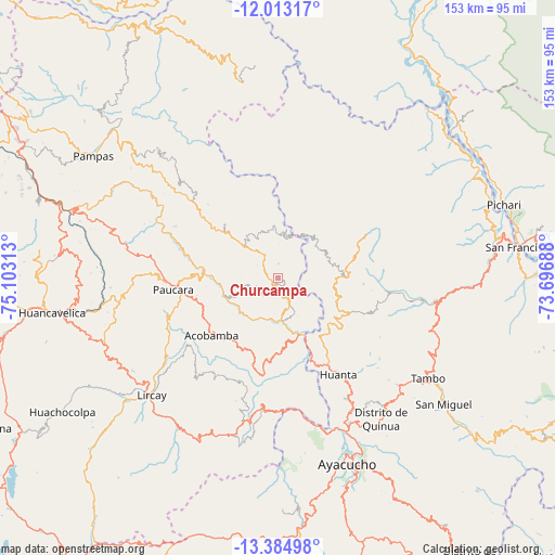
Churcampa GPS coordinates[2]
12° 42' 0" South, 74° 24' 0" West
| Map corner | latitude | longitude |
|---|---|---|
| Upper-left | -12.01317°, | -75.10313° |
| Center: | -12.7°, | -74.4° |
| Lower-right: | -13.38498°, | -73.69688° |
| Map W x H: | 152.5×152.5 km | = 94.8×94.8mi |
| max Lat: | -0.96667° ⇑58.7% North |
| Churcampa: | -12.7° |
| min Lat: | ⇓41.3% South -18.01465° |
| min Long | Churcampa | max Long |
| -81.30472° | -74.4° | -69.04167° |
| W 62.5%⇐ | ⇒37.5% E |
Elevation
Elevation of Churcampa is 3846 m = 12618 ft, and this is 1527.3 m = 5011 ft above average elevation for this country.
| Max E: |
5022 m = 16476 ft | 9.9% |
| Churcampa | 3846 m 12618 ft | |
| Avg. | 2318.7 m = 7607 ft | |
Min E: |
1 m = 3 ft | 90.1% |
See also: Peru elevation on elevation.city.
Geographical zone
Churcampa is located in South Torrid zone (between Equator and Tropic of Capricorn). Distance of this Southern Tropic circle is 1193.8 km =741.8 mi to South.| Distance of | km | miles | from Churcampa |
|---|---|---|---|
| Equator | 1412.1 | 877.4 | to North |
| Tropic Capricorn | 1193.8 | 741.8 | to South |
| Antarctic Circle | 5989.1 | 3721.5 | to South |
| South Pole | 8595 | 5340.7 | to South |


Nearby cities:
15 places around Churcampa: (largest is in red/bold)
• Acobamba
25.9 km =16.1 mi,  224°
224°
• Anchonga
38.4 km =23.9 mi,  237°
237°
• Caja
21.6 km =13.4 mi,  199°
199°
• Callanmarca
31.4 km =19.5 mi,  233°
233°
• Chincho
29.9 km =18.6 mi,  173°
173°
• Huanta
30.6 km =19 mi,  147°
147°
• Julcamarca
35.1 km =21.8 mi,  187°
187°
• La Esmeralda
22.9 km =14.2 mi,  288°
288°
• Locroja
4.1 km =2.5 mi,  297°
297°
• Luricocha
22.1 km =13.7 mi,  139°
139°
• Macachacra
38.2 km =23.7 mi, 145°
• Marcas
20.5 km =12.7 mi, 174°
• Mayocc
9.3 km =5.8 mi,  180°
180°
• Paucarbamba
23.3 km =14.5 mi,  315°
315°
• Pomacocha
20.9 km =13 mi, 217°
Sources, notices
• [Note1] Compared only with cities in Peru existing in our database
• [Src1] Map data: © OpenStreetMap contributors (CC-BY-SA)
• [Src2] Other city data from geonames.org with taken over terms of usage.
• [Src3] Geographical zone / Annual Mean Temperature by Robert A. Rohde @ Wikipedia
