Chocos geodata
Chocos (Lima region) is a seat of a third-order administrative division; located in Peru in America/Lima (GMT-5) time zone. In our database, there are 305 cities with bigger population. Compared to other cities in Peru, 60.5% of cities are located further ↑North; 51.9% of cities are located further →East and 54.3% of cities have higher elevation than Chocos. Note1


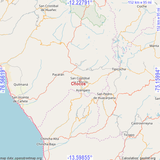
Chocos GPS coordinates[2]
12° 54' 51.012" South, 75° 51' 47.016" West
| Map corner | latitude | longitude |
|---|---|---|
| Upper-left | -12.22791°, | -76.56619° |
| Center: | -12.91417°, | -75.86306° |
| Lower-right: | -13.59855°, | -75.15994° |
| Map W x H: | 152.4×152.4 km | = 94.7×94.7mi |
| max Lat: | -0.96667° ⇑60.5% North |
| Chocos: | -12.91417° |
| min Lat: | ⇓39.5% South -18.01465° |
| min Long | Chocos | max Long |
| -81.30472° | -75.86306° | -69.04167° |
| W 48.1%⇐ | ⇒51.9% E |
Elevation
Elevation of Chocos is 2710 m = 8891 ft, and this is 391.3 m = 1284 ft above average elevation for this country.
| Max E: |
5022 m = 16476 ft | 54.3% |
| Chocos | 2710 m 8891 ft | |
| Avg. | 2318.7 m = 7607 ft | |
Min E: |
1 m = 3 ft | 45.7% |
See also: Peru elevation on elevation.city.
Geographical zone
Chocos is located in South Torrid zone (between Equator and Tropic of Capricorn). Distance of this Southern Tropic circle is 1170 km =727 mi to South.| Distance of | km | miles | from Chocos |
|---|---|---|---|
| Equator | 1435.9 | 892.2 | to North |
| Tropic Capricorn | 1170 | 727 | to South |
| Antarctic Circle | 5965.3 | 3706.7 | to South |
| South Pole | 8571.1 | 5325.8 | to South |


Nearby cities:
15 places around Chocos: (largest is in red/bold)
• Arma
42.2 km =26.2 mi,  122°
122°
• Cacra
14.2 km =8.8 mi,  37°
37°
• Catahuasi
13.2 km =8.2 mi,  346°
346°
• Chupamarca
31.4 km =19.5 mi,  114°
114°
• Colonia
31.4 km =19.5 mi, 354°
• Hongos
15.6 km =9.7 mi, 42°
• Huachos
49.2 km =30.6 mi,  130°
130°
• Huamatambo
29.8 km =18.5 mi,  139°
139°
• Huangascar
3.9 km =2.4 mi,  63°
63°
• Lincha
25 km =15.5 mi, 59°
• Madean
9.9 km =6.2 mi, 109°
• San Juan
39.3 km =24.4 mi, 144°
• Tauripampa
45.9 km =28.5 mi,  323°
323°
• Tupe
20.2 km =12.6 mi,  17°
17°
• Viñac
9.3 km =5.8 mi,  101°
101°
Sources, notices
• [Note1] Compared only with cities in Peru existing in our database
• [Src1] Map data: © OpenStreetMap contributors (CC-BY-SA)
• [Src2] Other city data from geonames.org with taken over terms of usage.
• [Src3] Geographical zone / Annual Mean Temperature by Robert A. Rohde @ Wikipedia
