Ugac Sur geodata
Ugac Sur (Cagayan Valley) is a populated place; located in Philippines in Asia/Manila (GMT+8) time zone. With population of 2,208 people, there are 3873 cities with bigger population in this country. Compared to other cities in Philippines, 96.7% of cities are located further ↓South; 63.8% of cities are located further →East and 54.4% of cities have lower elevation than Ugac Sur. Note1
Administrative division(s):
- Level 1: Cagayan Valley
- Level 2: Province of Cagayan
- Level 3: Tuguegarao City


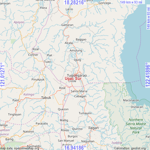
Ugac Sur GPS coordinates[2]
17° 36' 47.7" North, 121° 42' 56.988" East
| Map corner | latitude | longitude |
|---|---|---|
| Upper-left | 18.28216°, | 121.01271° |
| Center: | 17.61325°, | 121.71583° |
| Lower-right: | 16.94186°, | 122.41896° |
| Map W x H: | 149×149 km | = 92.6×92.6mi |
| max Lat: | 20.78733° ⇑3.3% North |
| Ugac Sur: | 17.61325° |
| min Lat: | ⇓96.7% South 4.65442° |
| min Long | Ugac Sur | max Long |
| 117.04868° | 121.71583° | 126.58417° |
| W 36.2%⇐ | ⇒63.8% E |
Elevation
Elevation of Ugac Sur is 27 m = 89 ft, and this is 60.9 m = 200 ft below average elevation for this country.
| Max E: |
2262 m = 7421 ft | 45.6% |
| Avg. | 87.9 m = 288 ft | |
| Ugac Sur | 27 m = 89 ft | |
Min E: |
-2 m = -7 ft | 54.4% |
See also: Philippines elevation on elevation.city.
Geographical zone
Ugac Sur is located in North Torrid zone (between Equator and Tropic of Cancer). Distance of this Northern Tropic circle is 647.5 km =402.3 mi to North.| Distance of | km | miles | from Ugac Sur |
|---|---|---|---|
| North Pole | 8048.7 | 5001.2 | to North |
| Arctic Circle | 5442.8 | 3382 | to North |
| Tropic Cancer | 647.5 | 402.3 | to North |
| Equator | 1958.4 | 1216.9 | to South |


Nearby cities:
15 places around Ugac Sur: (largest is in red/bold)
• Atulayan
6.2 km =3.9 mi,  337°
337°
• Carig
5.9 km =3.7 mi,  29°
29°
• Divisoria
11.8 km =7.3 mi,  148°
148°
• Dodan
8.9 km =5.5 mi,  69°
69°
• Enrile
6.3 km =3.9 mi,  198°
198°
• Gadu
11.3 km =7 mi,  279°
279°
• Gammad
11.2 km =7 mi,  15°
15°
• Lanna
9.3 km =5.8 mi,  349°
349°
• Larion Alto
5.1 km =3.2 mi, 67°
• Maddarulug Norte
4.2 km =2.6 mi,  260°
260°
• Magalalag
4.5 km =2.8 mi, 153°
• Nattapian
7 km =4.3 mi, 348°
• Peñablanca
7.3 km =4.5 mi, 72°
• Solana
5.1 km =3.2 mi,  329°
329°
• Tuguegarao
0.8 km =0.5 mi, 69°
Sources, notices
• [Note1] Compared only with cities in Philippines existing in our database
• [Src1] Map data: © OpenStreetMap contributors (CC-BY-SA)
• [Src2] Other city data from geonames.org with taken over terms of usage.
• [Src3] Geographical zone / Annual Mean Temperature by Robert A. Rohde @ Wikipedia
