Magalalag geodata
Magalalag (Cagayan Valley) is a populated place; located in Philippines in Asia/Manila (GMT+8) time zone. With population of 2,625 people, there are 3070 cities with bigger population in this country. Compared to other cities in Philippines, 96.4% of cities are located further ↓South; 63.5% of cities are located further →East and 55.6% of cities have lower elevation than Magalalag. Note1


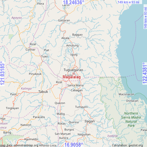
Magalalag GPS coordinates[2]
17° 34' 38.352" North, 121° 44' 5.892" East
| Map corner | latitude | longitude |
|---|---|---|
| Upper-left | 18.24636°, | 121.03185° |
| Center: | 17.57732°, | 121.73497° |
| Lower-right: | 16.9058°, | 122.4381° |
| Map W x H: | 149.1×149.1 km | = 92.6×92.6mi |
| max Lat: | 20.78733° ⇑3.6% North |
| Magalalag: | 17.57732° |
| min Lat: | ⇓96.4% South 4.65442° |
| min Long | Magalalag | max Long |
| 117.04868° | 121.73497° | 126.58417° |
| W 36.5%⇐ | ⇒63.5% E |
Elevation
Elevation of Magalalag is 28 m = 92 ft, and this is 59.9 m = 197 ft below average elevation for this country.
| Max E: |
2262 m = 7421 ft | 44.4% |
| Avg. | 87.9 m = 288 ft | |
| Magalalag | 28 m = 92 ft | |
Min E: |
-2 m = -7 ft | 55.6% |
See also: Philippines elevation on elevation.city.
Geographical zone
Magalalag is located in North Torrid zone (between Equator and Tropic of Cancer). Distance of this Northern Tropic circle is 651.5 km =404.8 mi to North.| Distance of | km | miles | from Magalalag |
|---|---|---|---|
| North Pole | 8052.6 | 5003.7 | to North |
| Arctic Circle | 5446.8 | 3384.5 | to North |
| Tropic Cancer | 651.5 | 404.8 | to North |
| Equator | 1954.4 | 1214.4 | to South |


Nearby cities:
15 places around Magalalag: (largest is in red/bold)
• Atulayan
10.7 km =6.6 mi,  335°
335°
• Bangad
10.1 km =6.3 mi,  153°
153°
• Calamagui East
10.5 km =6.5 mi,  160°
160°
• Carig
9.2 km =5.7 mi,  5°
5°
• Divisoria
7.4 km =4.6 mi, 145°
• Dodan
9.5 km =5.9 mi,  41°
41°
• Enrile
4.4 km =2.7 mi,  243°
243°
• Larion Alto
6.5 km =4 mi,  24°
24°
• Maddarulug Norte
7 km =4.3 mi,  298°
298°
• Nattapian
11.4 km =7.1 mi, 342°
• Peñablanca
7.9 km =4.9 mi, 38°
• Santa Maria
12.5 km =7.8 mi,  171°
171°
• Solana
9.6 km =6 mi,  330°
330°
• Tuguegarao
4.5 km =2.8 mi, 343°
• Ugac Sur
4.5 km =2.8 mi, 333°
Sources, notices
• [Note1] Compared only with cities in Philippines existing in our database
• [Src1] Map data: © OpenStreetMap contributors (CC-BY-SA)
• [Src2] Other city data from geonames.org with taken over terms of usage.
• [Src3] Geographical zone / Annual Mean Temperature by Robert A. Rohde @ Wikipedia
