Santa Cruz geodata
Santa Cruz (Central Luzon) is a populated place; located in Philippines in Asia/Manila (GMT+8) time zone. With population of 15,408 people, there are 438 cities with bigger population in this country. Compared to other cities in Philippines, 76.5% of cities are located further ↓South; 89.1% of cities are located further →East and 85.4% of cities have higher elevation than Santa Cruz. Note1


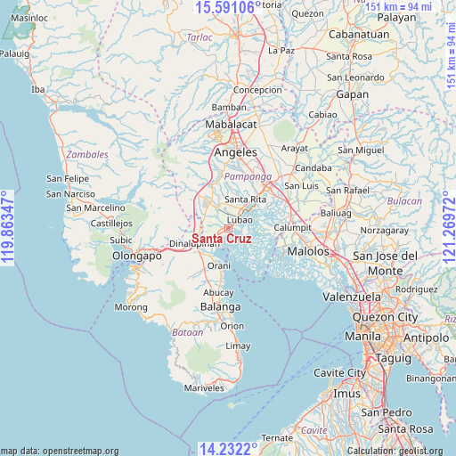
Santa Cruz GPS coordinates[2]
14° 54' 45.72" North, 120° 33' 59.724" East
| Map corner | latitude | longitude |
|---|---|---|
| Upper-left | 15.59106°, | 119.86347° |
| Center: | 14.9127°, | 120.56659° |
| Lower-right: | 14.2322°, | 121.26972° |
| Map W x H: | 151.1×151.1 km | = 93.9×93.9mi |
| max Lat: | 20.78733° ⇑23.5% North |
| Santa Cruz: | 14.9127° |
| min Lat: | ⇓76.5% South 4.65442° |
| min Long | Santa Cruz | max Long |
| 117.04868° | 120.56659° | 126.58417° |
| W 10.9%⇐ | ⇒89.1% E |
Elevation
Elevation of Santa Cruz is 8 m = 26 ft, and this is 79.9 m = 262 ft below average elevation for this country.
| Max E: |
2262 m = 7421 ft | 85.4% |
| Avg. | 87.9 m = 288 ft | |
| Santa Cruz | 8 m = 26 ft | |
Min E: |
-2 m = -7 ft | 14.6% |
See also: Philippines elevation on elevation.city.
Geographical zone
Santa Cruz is located in North Torrid zone (between Equator and Tropic of Cancer). Distance of this Northern Tropic circle is 947.8 km =588.9 mi to North.| Distance of | km | miles | from Santa Cruz |
|---|---|---|---|
| North Pole | 8348.9 | 5187.8 | to North |
| Arctic Circle | 5743 | 3568.5 | to North |
| Tropic Cancer | 947.8 | 588.9 | to North |
| Equator | 1658.1 | 1030.3 | to South |


Nearby cities:
15 places around Santa Cruz: (largest is in red/bold)
• Calangain
1.8 km =1.1 mi,  207°
207°
• Floridablanca
8.3 km =5.2 mi,  330°
330°
• Guagua
9.2 km =5.7 mi,  50°
50°
• Gutad
8.5 km =5.3 mi,  281°
281°
• Lubao
4.8 km =3 mi, 50°
• Malusac
8.4 km =5.2 mi,  135°
135°
• Maquiapo
8.2 km =5.1 mi,  353°
353°
• Prado Siongco
6.9 km =4.3 mi,  236°
236°
• San Antonio
7.7 km =4.8 mi,  38°
38°
• San Francisco
5.9 km =3.7 mi,  337°
337°
• San Roque Dau First
7.2 km =4.5 mi,  8°
8°
• Santa Teresa First
1.8 km =1.1 mi, 328°
• Santiago
6 km =3.7 mi,  260°
260°
• Santo Domingo
5.9 km =3.7 mi, 349°
• Sexmoan
7 km =4.3 mi,  60°
60°
Sources, notices
• [Note1] Compared only with cities in Philippines existing in our database
• [Src1] Map data: © OpenStreetMap contributors (CC-BY-SA)
• [Src2] Other city data from geonames.org with taken over terms of usage.
• [Src3] Geographical zone / Annual Mean Temperature by Robert A. Rohde @ Wikipedia
