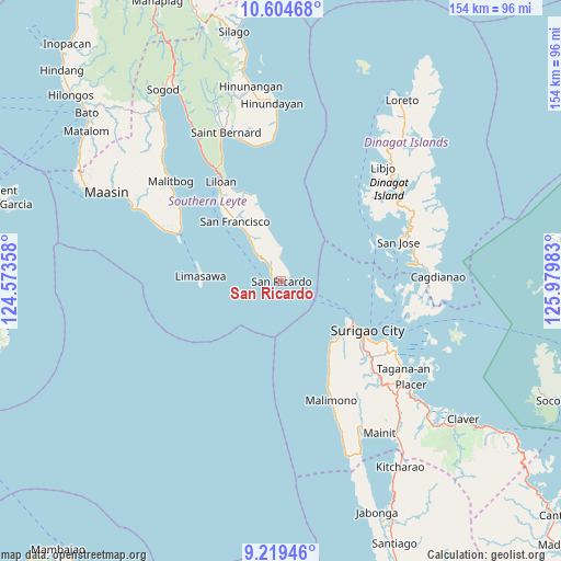
San Ricardo geodata
San Ricardo (Eastern Visayas) is a seat of a third-order administrative division; located in Philippines in Asia/Manila (GMT+8) time zone. In our database, there are 4166 cities with bigger population. Compared to other cities in Philippines, 69.2% of cities are located further ↑North; 91% of cities are located further ←West and 57.4% of cities have lower elevation than San Ricardo. Note1
Administrative division(s):
- Level 1: Eastern Visayas
- Level 2: Province of Southern Leyte
- Level 3: San Ricardo


San Ricardo GPS coordinates[2]
9° 54' 46.08" North, 125° 16' 36.12" East
| Map corner | latitude | longitude |
|---|---|---|
| Upper-left | 10.60468°, | 124.57358° |
| Center: | 9.9128°, | 125.2767° |
| Lower-right: | 9.21946°, | 125.97983° |
| Map W x H: | 154×154 km | = 95.7×95.7mi |
| max Lat: | 20.78733° ⇑69.2% North |
| San Ricardo: | 9.9128° |
| min Lat: | ⇓30.8% South 4.65442° |
| min Long | San Ricardo | max Long |
| 117.04868° | 125.2767° | 126.58417° |
| W 91%⇐ | ⇒9% E |
Elevation
Elevation of San Ricardo is 30 m = 98 ft, and this is 57.9 m = 190 ft below average elevation for this country.
| Max E: |
2262 m = 7421 ft | 42.6% |
| Avg. | 87.9 m = 288 ft | |
| San Ricardo | 30 m = 98 ft | |
Min E: |
-2 m = -7 ft | 57.4% |
See also: Philippines elevation on elevation.city.
Geographical zone
San Ricardo is located in North Torrid zone (between Equator and Tropic of Cancer). Distance of Equator is 1102.2 km =684.9 mi to South.| Distance of | km | miles | from San Ricardo |
|---|---|---|---|
| North Pole | 8904.9 | 5533.2 | to North |
| Arctic Circle | 6299 | 3914 | to North |
| Tropic Cancer | 1503.7 | 934.4 | to North |
| Equator | 1102.2 | 684.9 | to South |


Nearby cities:
15 places around San Ricardo: (largest is in red/bold)
• Basilisa
26.3 km =16.3 mi,  68°
68°
• Capalayan
35 km =21.7 mi,  123°
123°
• Dinagat
35 km =21.7 mi,  82°
82°
• Ipil
22.3 km =13.9 mi,  127°
127°
• Liloan
32.3 km =20.1 mi,  327°
327°
• Luna
31.1 km =19.3 mi, 128°
• Mabua
21.7 km =13.5 mi, 123°
• Malimono
35.5 km =22.1 mi,  157°
157°
• Mati
28.8 km =17.9 mi, 133°
• Padre Burgos
31.4 km =19.5 mi,  296°
296°
• Pintuyan
4.6 km =2.9 mi,  319°
319°
• Rizal
25.3 km =15.7 mi, 125°
• San Francisco
20.7 km =12.9 mi, 322°
• San Francisco
22.2 km =13.8 mi, 132°
• Surigao
27.6 km =17.1 mi, 119°
Sources, notices
• [Note1] Compared only with cities in Philippines existing in our database
• [Src1] Map data: © OpenStreetMap contributors (CC-BY-SA)
• [Src2] Other city data from geonames.org with taken over terms of usage.
• [Src3] Geographical zone / Annual Mean Temperature by Robert A. Rohde @ Wikipedia
