San Lucas geodata
San Lucas (Bicol) is a populated place; located in Philippines in Asia/Manila (GMT+8) time zone. With population of 2,267 people, there are 3752 cities with bigger population in this country. Compared to other cities in Philippines, 64.4% of cities are located further ↓South; 56.8% of cities are located further ←West and 95.5% of cities have higher elevation than San Lucas. Note1


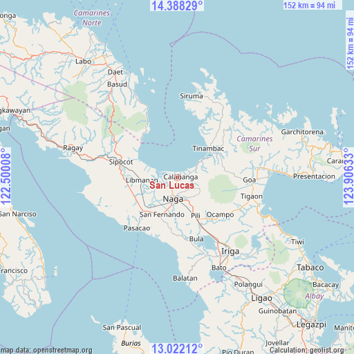
San Lucas GPS coordinates[2]
13° 42' 22.32" North, 123° 12' 11.52" East
| Map corner | latitude | longitude |
|---|---|---|
| Upper-left | 14.38829°, | 122.50008° |
| Center: | 13.7062°, | 123.2032° |
| Lower-right: | 13.02212°, | 123.90633° |
| Map W x H: | 151.9×151.9 km | = 94.4×94.4mi |
| max Lat: | 20.78733° ⇑35.6% North |
| San Lucas: | 13.7062° |
| min Lat: | ⇓64.4% South 4.65442° |
| min Long | San Lucas | max Long |
| 117.04868° | 123.2032° | 126.58417° |
| W 56.8%⇐ | ⇒43.2% E |
Elevation
Elevation of San Lucas is 5 m = 16 ft, and this is 82.9 m = 272 ft below average elevation for this country.
| Max E: |
2262 m = 7421 ft | 95.5% |
| Avg. | 87.9 m = 288 ft | |
| San Lucas | 5 m = 16 ft | |
Min E: |
-2 m = -7 ft | 4.5% |
See also: Philippines elevation on elevation.city.
Geographical zone
San Lucas is located in North Torrid zone (between Equator and Tropic of Cancer). Distance of this Northern Tropic circle is 1081.9 km =672.3 mi to North.| Distance of | km | miles | from San Lucas |
|---|---|---|---|
| North Pole | 8483.1 | 5271.2 | to North |
| Arctic Circle | 5877.2 | 3651.9 | to North |
| Tropic Cancer | 1081.9 | 672.3 | to North |
| Equator | 1524 | 947 | to South |


Nearby cities:
15 places around San Lucas: (largest is in red/bold)
• Binanwanaan
10.5 km =6.5 mi,  93°
93°
• Bombon
2 km =1.2 mi,  165°
165°
• Cabusao
9.5 km =5.9 mi,  281°
281°
• Calabanga
0.6 km =0.4 mi,  83°
83°
• Camaligan
10.1 km =6.3 mi,  202°
202°
• Canaman
7.4 km =4.6 mi,  209°
209°
• Castillo
9.8 km =6.1 mi,  286°
286°
• Dugcal
10.2 km =6.3 mi, 206°
• Magarao
5.4 km =3.4 mi, 199°
• Manquiring
7.8 km =4.8 mi,  66°
66°
• Marupit
9.7 km =6 mi, 204°
• Naga
10 km =6.2 mi,  193°
193°
• Paulba
5.1 km =3.2 mi, 80°
• San Vicente
0.8 km =0.5 mi, 206°
• Santo Domingo
4 km =2.5 mi,  260°
260°
Sources, notices
• [Note1] Compared only with cities in Philippines existing in our database
• [Src1] Map data: © OpenStreetMap contributors (CC-BY-SA)
• [Src2] Other city data from geonames.org with taken over terms of usage.
• [Src3] Geographical zone / Annual Mean Temperature by Robert A. Rohde @ Wikipedia
