San Antonio geodata
San Antonio (Cagayan Valley) is a populated place; located in Philippines in Asia/Manila (GMT+8) time zone. With population of 2,488 people, there are 3311 cities with bigger population in this country. Compared to other cities in Philippines, 90.3% of cities are located further ↓South; 73.5% of cities are located further →East and 93.5% of cities have lower elevation than San Antonio. Note1
Administrative division(s):
- Level 1: Cagayan Valley
- Level 2: Province of Nueva Vizcaya
- Level 3: Bambang


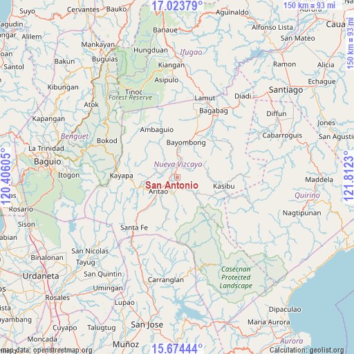
San Antonio GPS coordinates[2]
16° 21' 1.008" North, 121° 6' 33.012" East
| Map corner | latitude | longitude |
|---|---|---|
| Upper-left | 17.02379°, | 120.40605° |
| Center: | 16.35028°, | 121.10917° |
| Lower-right: | 15.67444°, | 121.8123° |
| Map W x H: | 150×150 km | = 93.2×93.2mi |
| max Lat: | 20.78733° ⇑9.7% North |
| San Antonio: | 16.35028° |
| min Lat: | ⇓90.3% South 4.65442° |
| min Long | San Antonio | max Long |
| 117.04868° | 121.10917° | 126.58417° |
| W 26.5%⇐ | ⇒73.5% E |
Elevation
Elevation of San Antonio is 348 m = 1142 ft, and this is 260.1 m = 853 ft above average elevation for this country.
| Max E: |
2262 m = 7421 ft | 6.5% |
| San Antonio | 348 m 1142 ft | |
| Avg. | 87.9 m = 288 ft | |
Min E: |
-2 m = -7 ft | 93.5% |
See also: Philippines elevation on elevation.city.
Geographical zone
San Antonio is located in North Torrid zone (between Equator and Tropic of Cancer). Distance of this Northern Tropic circle is 787.9 km =489.6 mi to North.| Distance of | km | miles | from San Antonio |
|---|---|---|---|
| North Pole | 8189.1 | 5088.5 | to North |
| Arctic Circle | 5583.2 | 3469.2 | to North |
| Tropic Cancer | 787.9 | 489.6 | to North |
| Equator | 1818 | 1129.7 | to South |


Nearby cities:
15 places around San Antonio: (largest is in red/bold)
• Almaguer North
1.8 km =1.1 mi,  267°
267°
• Aritao
9.9 km =6.2 mi,  233°
233°
• Baggabag B
19.3 km =12 mi,  26°
26°
• Bambang
4 km =2.5 mi,  356°
356°
• Banganan
7.1 km =4.4 mi,  235°
235°
• Bayombong
15.2 km =9.4 mi,  16°
16°
• Bone South
16.9 km =10.5 mi, 225°
• Buliwao
19.9 km =12.4 mi,  41°
41°
• Busilak
14.2 km =8.8 mi,  6°
6°
• Ineangan
4 km =2.5 mi,  205°
205°
• Mabasa
3.7 km =2.3 mi,  150°
150°
• Malasin
5.1 km =3.2 mi,  183°
183°
• Salinas
9.9 km =6.2 mi,  282°
282°
• San Fernando
5 km =3.1 mi, 29°
• Solano
20.3 km =12.6 mi, 22°
Sources, notices
• [Note1] Compared only with cities in Philippines existing in our database
• [Src1] Map data: © OpenStreetMap contributors (CC-BY-SA)
• [Src2] Other city data from geonames.org with taken over terms of usage.
• [Src3] Geographical zone / Annual Mean Temperature by Robert A. Rohde @ Wikipedia
