Buliwao geodata
Buliwao (Cagayan Valley) is a populated place; located in Philippines in Asia/Manila (GMT+8) time zone. With population of 2,380 people, there are 3499 cities with bigger population in this country. Compared to other cities in Philippines, 90.8% of cities are located further ↓South; 71.1% of cities are located further →East and 92.4% of cities have lower elevation than Buliwao. Note1
Administrative division(s):
- Level 1: Cagayan Valley
- Level 2: Province of Nueva Vizcaya
- Level 3: Quezon


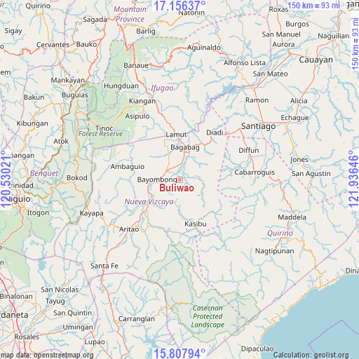
Buliwao GPS coordinates[2]
16° 28' 59.988" North, 121° 13' 59.988" East
| Map corner | latitude | longitude |
|---|---|---|
| Upper-left | 17.15637°, | 120.53021° |
| Center: | 16.48333°, | 121.23333° |
| Lower-right: | 15.80794°, | 121.93646° |
| Map W x H: | 149.9×149.9 km | = 93.1×93.1mi |
| max Lat: | 20.78733° ⇑9.2% North |
| Buliwao: | 16.48333° |
| min Lat: | ⇓90.8% South 4.65442° |
| min Long | Buliwao | max Long |
| 117.04868° | 121.23333° | 126.58417° |
| W 28.9%⇐ | ⇒71.1% E |
Elevation
Elevation of Buliwao is 299 m = 981 ft, and this is 211.1 m = 693 ft above average elevation for this country.
| Max E: |
2262 m = 7421 ft | 7.6% |
| Buliwao | 299 m 981 ft | |
| Avg. | 87.9 m = 288 ft | |
Min E: |
-2 m = -7 ft | 92.4% |
See also: Philippines elevation on elevation.city.
Geographical zone
Buliwao is located in North Torrid zone (between Equator and Tropic of Cancer). Distance of this Northern Tropic circle is 773.1 km =480.4 mi to North.| Distance of | km | miles | from Buliwao |
|---|---|---|---|
| North Pole | 8174.3 | 5079.3 | to North |
| Arctic Circle | 5568.4 | 3460 | to North |
| Tropic Cancer | 773.1 | 480.4 | to North |
| Equator | 1832.8 | 1138.8 | to South |


Nearby cities:
15 places around Buliwao: (largest is in red/bold)
• Bagabag
13.9 km =8.6 mi,  9°
9°
• Baggabag B
5.2 km =3.2 mi,  298°
298°
• Bambang
17.3 km =10.7 mi,  231°
231°
• Bayombong
8.9 km =5.5 mi,  268°
268°
• Bintawan
11.4 km =7.1 mi,  334°
334°
• Busilak
11.7 km =7.3 mi, 266°
• Ibung
14.9 km =9.3 mi,  340°
340°
• Kasibu
19.7 km =12.2 mi,  160°
160°
• Lamut
18.5 km =11.5 mi,  357°
357°
• Quezon
4 km =2.5 mi,  62°
62°
• San Fernando
15 km =9.3 mi, 225°
• Solano
6.8 km =4.2 mi,  305°
305°
• Tuao
12 km =7.5 mi, 12°
• Uddiawan
12.1 km =7.5 mi, 313°
• Villa Verde
13.7 km =8.5 mi, 339°
Sources, notices
• [Note1] Compared only with cities in Philippines existing in our database
• [Src1] Map data: © OpenStreetMap contributors (CC-BY-SA)
• [Src2] Other city data from geonames.org with taken over terms of usage.
• [Src3] Geographical zone / Annual Mean Temperature by Robert A. Rohde @ Wikipedia
