Ramos West geodata
Ramos West (Cagayan Valley) is a populated place; located in Philippines in Asia/Manila (GMT+8) time zone. With population of 3,042 people, there are 2480 cities with bigger population in this country. Compared to other cities in Philippines, 91.8% of cities are located further ↓South; 65.2% of cities are located further →East and 78% of cities have lower elevation than Ramos West. Note1
Administrative division(s):
- Level 1: Cagayan Valley
- Level 2: Province of Isabela
- Level 3: San Isidro


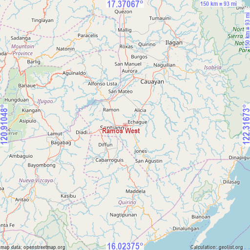
Ramos West GPS coordinates[2]
16° 41' 54.24" North, 121° 36' 48.96" East
| Map corner | latitude | longitude |
|---|---|---|
| Upper-left | 17.37067°, | 120.91048° |
| Center: | 16.6984°, | 121.6136° |
| Lower-right: | 16.02375°, | 122.31673° |
| Map W x H: | 149.8×149.8 km | = 93.1×93.1mi |
| max Lat: | 20.78733° ⇑8.2% North |
| Ramos West: | 16.6984° |
| min Lat: | ⇓91.8% South 4.65442° |
| min Long | Ramos West | max Long |
| 117.04868° | 121.6136° | 126.58417° |
| W 34.8%⇐ | ⇒65.2% E |
Elevation
Elevation of Ramos West is 80 m = 262 ft, and this is 7.9 m = 26 ft below average elevation for this country.
| Max E: |
2262 m = 7421 ft | 22% |
| Avg. | 87.9 m = 288 ft | |
| Ramos West | 80 m = 262 ft | |
Min E: |
-2 m = -7 ft | 78% |
See also: Philippines elevation on elevation.city.
Geographical zone
Ramos West is located in North Torrid zone (between Equator and Tropic of Cancer). Distance of this Northern Tropic circle is 749.2 km =465.5 mi to North.| Distance of | km | miles | from Ramos West |
|---|---|---|---|
| North Pole | 8150.4 | 5064.4 | to North |
| Arctic Circle | 5544.5 | 3445.2 | to North |
| Tropic Cancer | 749.2 | 465.5 | to North |
| Equator | 1856.7 | 1153.7 | to South |


Nearby cities:
15 places around Ramos West: (largest is in red/bold)
• Alicia
12.7 km =7.9 mi,  44°
44°
• Angadanan
15.7 km =9.8 mi,  66°
66°
• Batal
1.8 km =1.1 mi,  228°
228°
• Cabulay
13.4 km =8.3 mi,  292°
292°
• Cordon
16 km =9.9 mi,  260°
260°
• Diffun
16.7 km =10.4 mi,  223°
223°
• Echague
6.7 km =4.2 mi,  83°
83°
• Jones
18.4 km =11.4 mi,  148°
148°
• Pangal Sur
12.4 km =7.7 mi, 151°
• Ramon
12.7 km =7.9 mi,  318°
318°
• Rizal
6.6 km =4.1 mi, 289°
• Saguday
18.1 km =11.2 mi,  197°
197°
• San Isidro
3.9 km =2.4 mi,  4°
4°
• Santiago
7 km =4.3 mi, 260°
• Soyung
5.5 km =3.4 mi,  88°
88°
Sources, notices
• [Note1] Compared only with cities in Philippines existing in our database
• [Src1] Map data: © OpenStreetMap contributors (CC-BY-SA)
• [Src2] Other city data from geonames.org with taken over terms of usage.
• [Src3] Geographical zone / Annual Mean Temperature by Robert A. Rohde @ Wikipedia
