Quiling geodata
Quiling (Ilocos) is a populated place; located in Philippines in Asia/Manila (GMT+8) time zone. With population of 3,570 people, there are 2006 cities with bigger population in this country. Compared to other cities in Philippines, 98.5% of cities are located further ↓South; 89.7% of cities are located further →East and 54.5% of cities have higher elevation than Quiling. Note1
Administrative division(s):
- Level 1: Ilocos
- Level 2: Province of Ilocos Norte
- Level 3: City of Batac


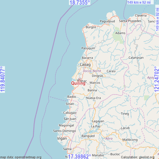
Quiling GPS coordinates[2]
18° 4' 5.988" North, 120° 32' 38.004" East
| Map corner | latitude | longitude |
|---|---|---|
| Upper-left | 18.7355°, | 119.84077° |
| Center: | 18.06833°, | 120.54389° |
| Lower-right: | 17.39862°, | 121.24702° |
| Map W x H: | 148.6×148.6 km | = 92.3×92.3mi |
| max Lat: | 20.78733° ⇑1.5% North |
| Quiling: | 18.06833° |
| min Lat: | ⇓98.5% South 4.65442° |
| min Long | Quiling | max Long |
| 117.04868° | 120.54389° | 126.58417° |
| W 10.3%⇐ | ⇒89.7% E |
Elevation
Elevation of Quiling is 20 m = 66 ft, and this is 67.9 m = 223 ft below average elevation for this country.
| Max E: |
2262 m = 7421 ft | 54.5% |
| Avg. | 87.9 m = 288 ft | |
| Quiling | 20 m = 66 ft | |
Min E: |
-2 m = -7 ft | 45.5% |
See also: Philippines elevation on elevation.city.
Geographical zone
Quiling is located in North Torrid zone (between Equator and Tropic of Cancer). Distance of this Northern Tropic circle is 596.9 km =370.9 mi to North.| Distance of | km | miles | from Quiling |
|---|---|---|---|
| North Pole | 7998.1 | 4969.8 | to North |
| Arctic Circle | 5392.2 | 3350.6 | to North |
| Tropic Cancer | 596.9 | 370.9 | to North |
| Equator | 2009 | 1248.3 | to South |


Nearby cities:
15 places around Quiling: (largest is in red/bold)
• Baay
6.5 km =4 mi,  30°
30°
• Batac City
2.6 km =1.6 mi,  122°
122°
• Bil-Loca
3.4 km =2.1 mi,  50°
50°
• Callaguip
6.1 km =3.8 mi,  273°
273°
• Currimao
8.2 km =5.1 mi,  226°
226°
• Espiritu
15.4 km =9.6 mi,  129°
129°
• Laoag
15.4 km =9.6 mi,  20°
20°
• Marcos
15.5 km =9.6 mi,  96°
96°
• Nagbacalan
5.7 km =3.5 mi,  337°
337°
• Paoay
2.4 km =1.5 mi,  252°
252°
• Pinili
13.1 km =8.1 mi,  187°
187°
• San Lorenzo
11.6 km =7.2 mi, 52°
• San Nicolas
12.8 km =8 mi, 25°
• Sarrat
14.7 km =9.1 mi, 47°
• Tabug
3.8 km =2.4 mi,  172°
172°
Sources, notices
• [Note1] Compared only with cities in Philippines existing in our database
• [Src1] Map data: © OpenStreetMap contributors (CC-BY-SA)
• [Src2] Other city data from geonames.org with taken over terms of usage.
• [Src3] Geographical zone / Annual Mean Temperature by Robert A. Rohde @ Wikipedia
