San Lorenzo geodata
San Lorenzo (Ilocos) is a populated place; located in Philippines in Asia/Manila (GMT+8) time zone. With population of 2,177 people, there are 3934 cities with bigger population in this country. Compared to other cities in Philippines, 98.7% of cities are located further ↓South; 87.2% of cities are located further →East and 51.8% of cities have higher elevation than San Lorenzo. Note1


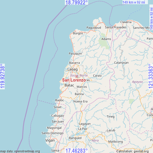
San Lorenzo GPS coordinates[2]
18° 7' 56.28" North, 120° 37' 49.8" East
| Map corner | latitude | longitude |
|---|---|---|
| Upper-left | 18.79922°, | 119.92738° |
| Center: | 18.1323°, | 120.6305° |
| Lower-right: | 17.46283°, | 121.33363° |
| Map W x H: | 148.6×148.6 km | = 92.3×92.3mi |
| max Lat: | 20.78733° ⇑1.3% North |
| San Lorenzo: | 18.1323° |
| min Lat: | ⇓98.7% South 4.65442° |
| min Long | San Lorenzo | max Long |
| 117.04868° | 120.6305° | 126.58417° |
| W 12.8%⇐ | ⇒87.2% E |
Elevation
Elevation of San Lorenzo is 22 m = 72 ft, and this is 65.9 m = 216 ft below average elevation for this country.
| Max E: |
2262 m = 7421 ft | 51.8% |
| Avg. | 87.9 m = 288 ft | |
| San Lorenzo | 22 m = 72 ft | |
Min E: |
-2 m = -7 ft | 48.2% |
See also: Philippines elevation on elevation.city.
Geographical zone
San Lorenzo is located in North Torrid zone (between Equator and Tropic of Cancer). Distance of this Northern Tropic circle is 589.8 km =366.5 mi to North.| Distance of | km | miles | from San Lorenzo |
|---|---|---|---|
| North Pole | 7990.9 | 4965.3 | to North |
| Arctic Circle | 5385.1 | 3346.1 | to North |
| Tropic Cancer | 589.8 | 366.5 | to North |
| Equator | 2016.1 | 1252.7 | to South |


Nearby cities:
15 places around San Lorenzo: (largest is in red/bold)
• Baay
6 km =3.7 mi,  255°
255°
• Bacarra
13.5 km =8.4 mi,  351°
351°
• Barong
13.7 km =8.5 mi,  127°
127°
• Batac City
11 km =6.8 mi,  219°
219°
• Bil-Loca
8.2 km =5.1 mi,  232°
232°
• Dingras
7.7 km =4.8 mi,  114°
114°
• Laoag
8.2 km =5.1 mi,  333°
333°
• Marcos
10.9 km =6.8 mi,  144°
144°
• Nagbacalan
11.5 km =7.1 mi, 260°
• Piddig
9.9 km =6.2 mi,  68°
68°
• Quiling
11.6 km =7.2 mi, 232°
• San Nicolas
5.8 km =3.6 mi,  320°
320°
• Sarrat
3.3 km =2.1 mi,  31°
31°
• Tabug
13.9 km =8.6 mi, 218°
• Vintar
10.8 km =6.7 mi,  9°
9°
Sources, notices
• [Note1] Compared only with cities in Philippines existing in our database
• [Src1] Map data: © OpenStreetMap contributors (CC-BY-SA)
• [Src2] Other city data from geonames.org with taken over terms of usage.
• [Src3] Geographical zone / Annual Mean Temperature by Robert A. Rohde @ Wikipedia
