Pangabuan geodata
Pangabuan (Northern Mindanao) is a populated place; located in Philippines in Asia/Manila (GMT+8) time zone. With population of 2,098 people, there are 4079 cities with bigger population in this country. Compared to other cities in Philippines, 82% of cities are located further ↑North; 65.5% of cities are located further ←West and 63.6% of cities have lower elevation than Pangabuan. Note1
Administrative division(s):
- Level 1: Northern Mindanao
- Level 2: Province of Misamis Occidental
- Level 3: Tangub City


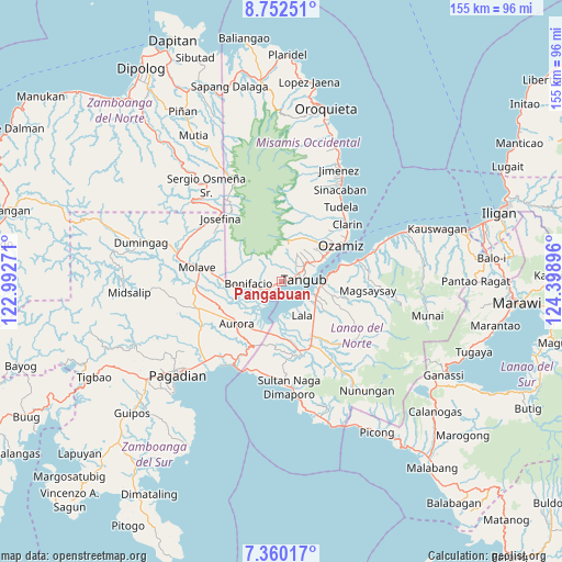
Pangabuan GPS coordinates[2]
8° 3' 24.984" North, 123° 41' 44.988" East
| Map corner | latitude | longitude |
|---|---|---|
| Upper-left | 8.75251°, | 122.99271° |
| Center: | 8.05694°, | 123.69583° |
| Lower-right: | 7.36017°, | 124.39896° |
| Map W x H: | 154.8×154.8 km | = 96.2×96.2mi |
| max Lat: | 20.78733° ⇑82% North |
| Pangabuan: | 8.05694° |
| min Lat: | ⇓18% South 4.65442° |
| min Long | Pangabuan | max Long |
| 117.04868° | 123.69583° | 126.58417° |
| W 65.5%⇐ | ⇒34.5% E |
Elevation
Elevation of Pangabuan is 39 m = 128 ft, and this is 48.9 m = 160 ft below average elevation for this country.
| Max E: |
2262 m = 7421 ft | 36.4% |
| Avg. | 87.9 m = 288 ft | |
| Pangabuan | 39 m = 128 ft | |
Min E: |
-2 m = -7 ft | 63.6% |
See also: Philippines elevation on elevation.city.
Geographical zone
Pangabuan is located in North Torrid zone (between Equator and Tropic of Cancer). Distance of Equator is 895.8 km =556.6 mi to South.| Distance of | km | miles | from Pangabuan |
|---|---|---|---|
| North Pole | 9111.2 | 5661.4 | to North |
| Arctic Circle | 6505.3 | 4042.2 | to North |
| Tropic Cancer | 1710.1 | 1062.6 | to North |
| Equator | 895.8 | 556.6 | to South |


Nearby cities:
15 places around Pangabuan: (largest is in red/bold)
• Bagakay
16.5 km =10.3 mi,  53°
53°
• Baroy
9.7 km =6 mi,  110°
110°
• Bonifacio
9 km =5.6 mi,  266°
266°
• Dimaluna
13.5 km =8.4 mi,  57°
57°
• Lala
10.9 km =6.8 mi,  148°
148°
• Lanipao
14.4 km =8.9 mi,  141°
141°
• Lapining
14.9 km =9.3 mi,  183°
183°
• Maranding
16.9 km =10.5 mi, 150°
• Margos
14.5 km =9 mi,  196°
196°
• Panalo-on
16.7 km =10.4 mi,  159°
159°
• Sumalig
7.4 km =4.6 mi,  209°
209°
• Tabid
10.9 km =6.8 mi, 58°
• Taguitic
14.9 km =9.3 mi, 208°
• Tangub
5.7 km =3.5 mi,  84°
84°
• Tubod
10.4 km =6.5 mi,  90°
90°
Sources, notices
• [Note1] Compared only with cities in Philippines existing in our database
• [Src1] Map data: © OpenStreetMap contributors (CC-BY-SA)
• [Src2] Other city data from geonames.org with taken over terms of usage.
• [Src3] Geographical zone / Annual Mean Temperature by Robert A. Rohde @ Wikipedia
