Palampas geodata
Palampas (Western Visayas) is a populated place; located in Philippines in Asia/Manila (GMT+8) time zone. With population of 9,037 people, there are 683 cities with bigger population in this country. Compared to other cities in Philippines, 62.9% of cities are located further ↑North; 60.8% of cities are located further ←West and 70% of cities have lower elevation than Palampas. Note1
Administrative division(s):
- Level 1: Western Visayas
- Level 2: Province of Negros Occidental
- Level 3: San Carlos City


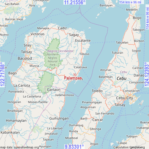
Palampas GPS coordinates[2]
10° 31' 30.216" North, 123° 25' 14.88" East
| Map corner | latitude | longitude |
|---|---|---|
| Upper-left | 11.21556°, | 122.71768° |
| Center: | 10.52506°, | 123.4208° |
| Lower-right: | 9.83301°, | 124.12393° |
| Map W x H: | 153.7×153.7 km | = 95.5×95.5mi |
| max Lat: | 20.78733° ⇑62.9% North |
| Palampas: | 10.52506° |
| min Lat: | ⇓37.1% South 4.65442° |
| min Long | Palampas | max Long |
| 117.04868° | 123.4208° | 126.58417° |
| W 60.8%⇐ | ⇒39.2% E |
Elevation
Elevation of Palampas is 52 m = 171 ft, and this is 35.9 m = 118 ft below average elevation for this country.
| Max E: |
2262 m = 7421 ft | 30% |
| Avg. | 87.9 m = 288 ft | |
| Palampas | 52 m = 171 ft | |
Min E: |
-2 m = -7 ft | 70% |
See also: Philippines elevation on elevation.city.
Geographical zone
Palampas is located in North Torrid zone (between Equator and Tropic of Cancer). Distance of Equator is 1170.3 km =727.2 mi to South.| Distance of | km | miles | from Palampas |
|---|---|---|---|
| North Pole | 8836.8 | 5490.9 | to North |
| Arctic Circle | 6230.9 | 3871.7 | to North |
| Tropic Cancer | 1435.6 | 892 | to North |
| Equator | 1170.3 | 727.2 | to South |


Nearby cities:
15 places around Palampas: (largest is in red/bold)
• Agpangi
5.8 km =3.6 mi,  2°
2°
• Buenavista
3.6 km =2.2 mi,  54°
54°
• Buluangan
17.8 km =11.1 mi,  210°
210°
• Calampisauan
11.2 km =7 mi,  32°
32°
• Calatrava
10.4 km =6.5 mi,  41°
41°
• Codcod
19.9 km =12.4 mi,  249°
249°
• Guadalupe
9.4 km =5.8 mi, 213°
• Hacienda Refugio
2.6 km =1.6 mi,  98°
98°
• Igmaya-an
22.1 km =13.7 mi,  277°
277°
• Minapasoc
20.9 km =13 mi,  337°
337°
• Patonan
7.4 km =4.6 mi, 49°
• Prosperidad
12.3 km =7.6 mi,  265°
265°
• Punao
4.7 km =2.9 mi, 342°
• Quezon
20.1 km =12.5 mi,  240°
240°
• Ualog
6.2 km =3.9 mi,  331°
331°
Sources, notices
• [Note1] Compared only with cities in Philippines existing in our database
• [Src1] Map data: © OpenStreetMap contributors (CC-BY-SA)
• [Src2] Other city data from geonames.org with taken over terms of usage.
• [Src3] Geographical zone / Annual Mean Temperature by Robert A. Rohde @ Wikipedia
