Patonan geodata
Patonan (Western Visayas) is a populated place; located in Philippines in Asia/Manila (GMT+8) time zone. With population of 2,509 people, there are 3269 cities with bigger population in this country. Compared to other cities in Philippines, 62.4% of cities are located further ↑North; 61.6% of cities are located further ←West and 99.6% of cities have higher elevation than Patonan. Note1
Administrative division(s):
- Level 1: Western Visayas
- Level 2: Province of Negros Occidental
- Level 3: Calatrava


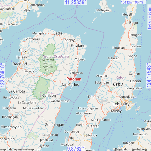
Patonan GPS coordinates[2]
10° 34' 5.376" North, 123° 28' 20.28" East
| Map corner | latitude | longitude |
|---|---|---|
| Upper-left | 11.25856°, | 122.76918° |
| Center: | 10.56816°, | 123.4723° |
| Lower-right: | 9.8762°, | 124.17543° |
| Map W x H: | 153.7×153.7 km | = 95.5×95.5mi |
| max Lat: | 20.78733° ⇑62.4% North |
| Patonan: | 10.56816° |
| min Lat: | ⇓37.6% South 4.65442° |
| min Long | Patonan | max Long |
| 117.04868° | 123.4723° | 126.58417° |
| W 61.6%⇐ | ⇒38.4% E |
Elevation
Elevation of Patonan is 1 m = 3 ft, and this is 86.9 m = 285 ft below average elevation for this country.
| Max E: |
2262 m = 7421 ft | 99.6% |
| Avg. | 87.9 m = 288 ft | |
| Patonan | 1 m = 3 ft | |
Min E: |
-2 m = -7 ft | 0.4% |
See also: Philippines elevation on elevation.city.
Geographical zone
Patonan is located in North Torrid zone (between Equator and Tropic of Cancer). Distance of Equator is 1175.1 km =730.2 mi to South.| Distance of | km | miles | from Patonan |
|---|---|---|---|
| North Pole | 8832 | 5487.9 | to North |
| Arctic Circle | 6226.1 | 3868.7 | to North |
| Tropic Cancer | 1430.8 | 889.1 | to North |
| Equator | 1175.1 | 730.2 | to South |


Nearby cities:
15 places around Patonan: (largest is in red/bold)
• Agpangi
5.5 km =3.4 mi,  280°
280°
• Buenavista
3.8 km =2.4 mi,  224°
224°
• Bugang
21.2 km =13.2 mi,  335°
335°
• Calampisauan
4.7 km =2.9 mi,  5°
5°
• Calatrava
3.2 km =2 mi,  22°
22°
• Guadalupe
16.6 km =10.3 mi, 220°
• Hacienda Refugio
6 km =3.7 mi,  210°
210°
• Japitan
23.3 km =14.5 mi, 19°
• Minapasoc
19.8 km =12.3 mi,  317°
317°
• Palampas
7.4 km =4.6 mi,  229°
229°
• Prosperidad
18.8 km =11.7 mi,  252°
252°
• Punao
7 km =4.3 mi,  267°
267°
• Salamanca
20.8 km =12.9 mi, 17°
• Toboso
16.9 km =10.5 mi, 16°
• Ualog
8.7 km =5.4 mi, 274°
Sources, notices
• [Note1] Compared only with cities in Philippines existing in our database
• [Src1] Map data: © OpenStreetMap contributors (CC-BY-SA)
• [Src2] Other city data from geonames.org with taken over terms of usage.
• [Src3] Geographical zone / Annual Mean Temperature by Robert A. Rohde @ Wikipedia
