Obando geodata
Obando (Central Luzon) is a seat of a third-order administrative division; located in Philippines in Asia/Manila (GMT+8) time zone. With population of 59,929 people, there are 157 cities with bigger population in this country. Compared to other cities in Philippines, 75.2% of cities are located further ↓South; 78.3% of cities are located further →East and 92.7% of cities have higher elevation than Obando. Note1


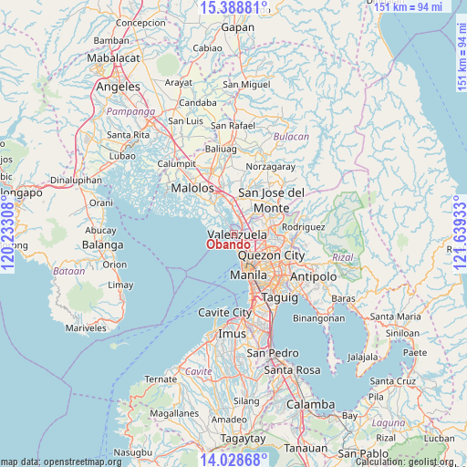
Obando GPS coordinates[2]
14° 42' 35.28" North, 120° 56' 10.32" East
| Map corner | latitude | longitude |
|---|---|---|
| Upper-left | 15.38881°, | 120.23308° |
| Center: | 14.7098°, | 120.9362° |
| Lower-right: | 14.02868°, | 121.63933° |
| Map W x H: | 151.2×151.2 km | = 94×94mi |
| max Lat: | 20.78733° ⇑24.8% North |
| Obando: | 14.7098° |
| min Lat: | ⇓75.2% South 4.65442° |
| min Long | Obando | max Long |
| 117.04868° | 120.9362° | 126.58417° |
| W 21.7%⇐ | ⇒78.3% E |
Elevation
Elevation of Obando is 6 m = 20 ft, and this is 81.9 m = 269 ft below average elevation for this country.
| Max E: |
2262 m = 7421 ft | 92.7% |
| Avg. | 87.9 m = 288 ft | |
| Obando | 6 m = 20 ft | |
Min E: |
-2 m = -7 ft | 7.3% |
See also: Obando elevation on elevation.city.
Geographical zone
Obando is located in North Torrid zone (between Equator and Tropic of Cancer). Distance of this Northern Tropic circle is 970.3 km =602.9 mi to North.| Distance of | km | miles | from Obando |
|---|---|---|---|
| North Pole | 8371.5 | 5201.8 | to North |
| Arctic Circle | 5765.6 | 3582.6 | to North |
| Tropic Cancer | 970.3 | 602.9 | to North |
| Equator | 1635.6 | 1016.3 | to South |


Nearby cities:
15 places around Obando: (largest is in red/bold)
• Angat
11.1 km =6.9 mi,  326°
326°
• Bagong Pagasa
11.6 km =7.2 mi,  116°
116°
• Bocaue
9.9 km =6.2 mi,  353°
353°
• Caloocan City
7.5 km =4.7 mi,  153°
153°
• Del Monte
11.6 km =7.2 mi,  130°
130°
• Lambakin
8.7 km =5.4 mi,  300°
300°
• Loma de Gato
11.1 km =6.9 mi,  37°
37°
• Malabon
4.1 km =2.5 mi,  174°
174°
• Marilao
5.5 km =3.4 mi,  13°
13°
• Meycauayan
4 km =2.5 mi, 41°
• Navotas
5 km =3.1 mi,  162°
162°
• Niugan
5.4 km =3.4 mi, 157°
• Sulucan
9.5 km =5.9 mi, 353°
• Tanza
3.8 km =2.4 mi,  175°
175°
• Valenzuela
3.5 km =2.2 mi,  108°
108°
Sources, notices
• [Note1] Compared only with cities in Philippines existing in our database
• [Src1] Map data: © OpenStreetMap contributors (CC-BY-SA)
• [Src2] Other city data from geonames.org with taken over terms of usage.
• [Src3] Geographical zone / Annual Mean Temperature by Robert A. Rohde @ Wikipedia
