Moises Padilla geodata
Moises Padilla (Western Visayas) is a seat of a third-order administrative division; located in Philippines in Asia/Manila (GMT+8) time zone. In our database, there are 4166 cities with bigger population. Compared to other cities in Philippines, 65.5% of cities are located further ↑North; 54.7% of cities are located further ←West and 65.9% of cities have lower elevation than Moises Padilla. Note1
Administrative division(s):
- Level 1: Western Visayas
- Level 2: Province of Negros Occidental
- Level 3: Moises Padilla (Magallon)


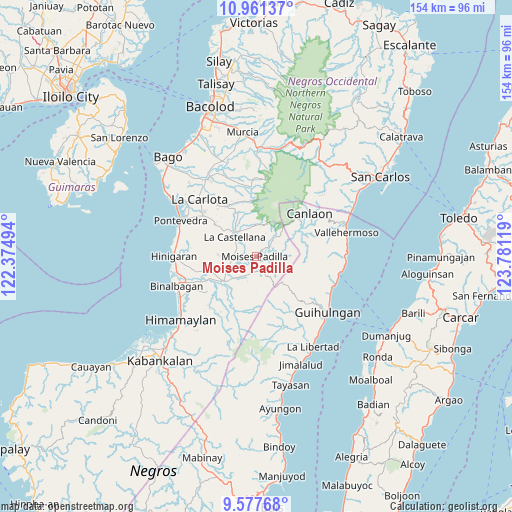
Moises Padilla GPS coordinates[2]
10° 16' 13.008" North, 123° 4' 41.016" East
| Map corner | latitude | longitude |
|---|---|---|
| Upper-left | 10.96137°, | 122.37494° |
| Center: | 10.27028°, | 123.07806° |
| Lower-right: | 9.57768°, | 123.78119° |
| Map W x H: | 153.9×153.9 km | = 95.6×95.6mi |
| max Lat: | 20.78733° ⇑65.5% North |
| Moises Padilla: | 10.27028° |
| min Lat: | ⇓34.5% South 4.65442° |
| min Long | Moises Padilla | max Long |
| 117.04868° | 123.07806° | 126.58417° |
| W 54.7%⇐ | ⇒45.3% E |
Elevation
Elevation of Moises Padilla is 43 m = 141 ft, and this is 44.9 m = 147 ft below average elevation for this country.
| Max E: |
2262 m = 7421 ft | 34.1% |
| Avg. | 87.9 m = 288 ft | |
| Moises Padilla | 43 m = 141 ft | |
Min E: |
-2 m = -7 ft | 65.9% |
See also: Philippines elevation on elevation.city.
Geographical zone
Moises Padilla is located in North Torrid zone (between Equator and Tropic of Cancer). Distance of Equator is 1141.9 km =709.5 mi to South.| Distance of | km | miles | from Moises Padilla |
|---|---|---|---|
| North Pole | 8865.1 | 5508.5 | to North |
| Arctic Circle | 6259.2 | 3889.3 | to North |
| Tropic Cancer | 1464 | 909.7 | to North |
| Equator | 1141.9 | 709.5 | to South |


Nearby cities:
15 places around Moises Padilla: (largest is in red/bold)
• Bulad
8.9 km =5.5 mi,  258°
258°
• Cabacungan
8.5 km =5.3 mi,  45°
45°
• Calape
11.4 km =7.1 mi,  271°
271°
• Camalobalo
14 km =8.7 mi, 271°
• Camandag
7.1 km =4.4 mi,  349°
349°
• Camangcamang
14.3 km =8.9 mi,  224°
224°
• Isabela
12.2 km =7.6 mi,  233°
233°
• La Castellana
8.6 km =5.3 mi,  313°
313°
• Lalagsan
7.2 km =4.5 mi,  280°
280°
• Magallon Cadre
2.5 km =1.6 mi,  37°
37°
• Odiong
3.3 km =2.1 mi,  301°
301°
• Sagang
10.1 km =6.3 mi,  356°
356°
• Santol
14.2 km =8.8 mi, 219°
• Tinongan
7.7 km =4.8 mi, 217°
• Yubo
13.3 km =8.3 mi, 355°
Sources, notices
• [Note1] Compared only with cities in Philippines existing in our database
• [Src1] Map data: © OpenStreetMap contributors (CC-BY-SA)
• [Src2] Other city data from geonames.org with taken over terms of usage.
• [Src3] Geographical zone / Annual Mean Temperature by Robert A. Rohde @ Wikipedia
