Lalagsan geodata
Lalagsan (Western Visayas) is a populated place; located in Philippines in Asia/Manila (GMT+8) time zone. With population of 2,941 people, there are 2598 cities with bigger population in this country. Compared to other cities in Philippines, 65.3% of cities are located further ↑North; 53.4% of cities are located further ←West and 62.9% of cities have lower elevation than Lalagsan. Note1
Administrative division(s):
- Level 1: Western Visayas
- Level 2: Province of Negros Occidental
- Level 3: La Castellana


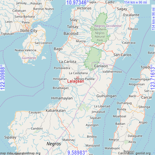
Lalagsan GPS coordinates[2]
10° 16' 56.64" North, 123° 0' 46.8" East
| Map corner | latitude | longitude |
|---|---|---|
| Upper-left | 10.97346°, | 122.30988° |
| Center: | 10.2824°, | 123.013° |
| Lower-right: | 9.58983°, | 123.71613° |
| Map W x H: | 153.8×153.8 km | = 95.6×95.6mi |
| max Lat: | 20.78733° ⇑65.3% North |
| Lalagsan: | 10.2824° |
| min Lat: | ⇓34.7% South 4.65442° |
| min Long | Lalagsan | max Long |
| 117.04868° | 123.013° | 126.58417° |
| W 53.4%⇐ | ⇒46.6% E |
Elevation
Elevation of Lalagsan is 38 m = 125 ft, and this is 49.9 m = 164 ft below average elevation for this country.
| Max E: |
2262 m = 7421 ft | 37.1% |
| Avg. | 87.9 m = 288 ft | |
| Lalagsan | 38 m = 125 ft | |
Min E: |
-2 m = -7 ft | 62.9% |
See also: Philippines elevation on elevation.city.
Geographical zone
Lalagsan is located in North Torrid zone (between Equator and Tropic of Cancer). Distance of Equator is 1143.3 km =710.4 mi to South.| Distance of | km | miles | from Lalagsan |
|---|---|---|---|
| North Pole | 8863.8 | 5507.7 | to North |
| Arctic Circle | 6257.9 | 3888.5 | to North |
| Tropic Cancer | 1462.6 | 908.8 | to North |
| Equator | 1143.3 | 710.4 | to South |


Nearby cities:
15 places around Lalagsan: (largest is in red/bold)
• Antipolo
9.8 km =6.1 mi,  327°
327°
• Aranda
8.9 km =5.5 mi,  234°
234°
• Bulad
3.5 km =2.2 mi,  207°
207°
• Calape
4.3 km =2.7 mi,  256°
256°
• Camalobalo
6.9 km =4.3 mi, 261°
• Camandag
8.2 km =5.1 mi,  46°
46°
• Camangcamang
11.8 km =7.3 mi,  194°
194°
• Guintubhan
10 km =6.2 mi, 213°
• Isabela
9 km =5.6 mi,  197°
197°
• La Castellana
4.7 km =2.9 mi,  11°
11°
• Magallon Cadre
8.7 km =5.4 mi,  85°
85°
• Moises Padilla
7.2 km =4.5 mi,  100°
100°
• Odiong
4.3 km =2.7 mi, 85°
• Sagang
10.9 km =6.8 mi,  36°
36°
• Tinongan
7.9 km =4.9 mi,  161°
161°
Sources, notices
• [Note1] Compared only with cities in Philippines existing in our database
• [Src1] Map data: © OpenStreetMap contributors (CC-BY-SA)
• [Src2] Other city data from geonames.org with taken over terms of usage.
• [Src3] Geographical zone / Annual Mean Temperature by Robert A. Rohde @ Wikipedia
