Camangcamang geodata
Camangcamang (Western Visayas) is a populated place; located in Philippines in Asia/Manila (GMT+8) time zone. With population of 4,131 people, there are 1649 cities with bigger population in this country. Compared to other cities in Philippines, 66.5% of cities are located further ↑North; 53% of cities are located further ←West and 60.9% of cities have lower elevation than Camangcamang. Note1
Administrative division(s):
- Level 1: Western Visayas
- Level 2: Province of Negros Occidental
- Level 3: Isabela


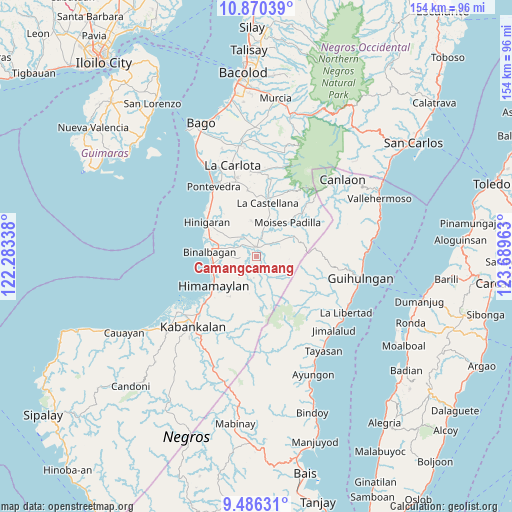
Camangcamang GPS coordinates[2]
10° 10' 44.76" North, 122° 59' 11.4" East
| Map corner | latitude | longitude |
|---|---|---|
| Upper-left | 10.87039°, | 122.28338° |
| Center: | 10.1791°, | 122.9865° |
| Lower-right: | 9.48631°, | 123.68963° |
| Map W x H: | 153.9×153.9 km | = 95.6×95.6mi |
| max Lat: | 20.78733° ⇑66.5% North |
| Camangcamang: | 10.1791° |
| min Lat: | ⇓33.5% South 4.65442° |
| min Long | Camangcamang | max Long |
| 117.04868° | 122.9865° | 126.58417° |
| W 53%⇐ | ⇒47% E |
Elevation
Elevation of Camangcamang is 35 m = 115 ft, and this is 52.9 m = 174 ft below average elevation for this country.
| Max E: |
2262 m = 7421 ft | 39.1% |
| Avg. | 87.9 m = 288 ft | |
| Camangcamang | 35 m = 115 ft | |
Min E: |
-2 m = -7 ft | 60.9% |
See also: Philippines elevation on elevation.city.
Geographical zone
Camangcamang is located in North Torrid zone (between Equator and Tropic of Cancer). Distance of Equator is 1131.8 km =703.3 mi to South.| Distance of | km | miles | from Camangcamang |
|---|---|---|---|
| North Pole | 8875.3 | 5514.9 | to North |
| Arctic Circle | 6269.4 | 3895.6 | to North |
| Tropic Cancer | 1474.1 | 916 | to North |
| Equator | 1131.8 | 703.3 | to South |


Nearby cities:
15 places around Camangcamang: (largest is in red/bold)
• Aranda
7.7 km =4.8 mi,  325°
325°
• Bagroy
6.1 km =3.8 mi,  295°
295°
• Biao
7.9 km =4.9 mi,  187°
187°
• Bulad
8.5 km =5.3 mi,  8°
8°
• Cabadiangan
6 km =3.7 mi,  232°
232°
• Calape
10.6 km =6.6 mi,  352°
352°
• Cansolungon
3.4 km =2.1 mi,  158°
158°
• Carabalan
10.2 km =6.3 mi,  205°
205°
• Guintubhan
4.1 km =2.5 mi,  320°
320°
• Isabela
2.9 km =1.8 mi, 5°
• Libacao
8 km =5 mi,  270°
270°
• Montilla
7.1 km =4.4 mi,  291°
291°
• Payao
6.9 km =4.3 mi, 269°
• Santol
1.2 km =0.7 mi,  129°
129°
• Tinongan
6.7 km =4.2 mi,  53°
53°
Sources, notices
• [Note1] Compared only with cities in Philippines existing in our database
• [Src1] Map data: © OpenStreetMap contributors (CC-BY-SA)
• [Src2] Other city data from geonames.org with taken over terms of usage.
• [Src3] Geographical zone / Annual Mean Temperature by Robert A. Rohde @ Wikipedia
