Maugat West geodata
Maugat West (Calabarzon) is a populated place; located in Philippines in Asia/Manila (GMT+8) time zone. With population of 2,613 people, there are 3087 cities with bigger population in this country. Compared to other cities in Philippines, 66.6% of cities are located further ↓South; 70.4% of cities are located further →East and 78.7% of cities have lower elevation than Maugat West. Note1


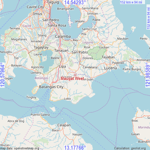
Maugat West GPS coordinates[2]
13° 51' 40.68" North, 121° 16' 57.936" East
| Map corner | latitude | longitude |
|---|---|---|
| Upper-left | 14.54293°, | 120.57964° |
| Center: | 13.8613°, | 121.28276° |
| Lower-right: | 13.17766°, | 121.98589° |
| Map W x H: | 151.8×151.8 km | = 94.3×94.3mi |
| max Lat: | 20.78733° ⇑33.4% North |
| Maugat West: | 13.8613° |
| min Lat: | ⇓66.6% South 4.65442° |
| min Long | Maugat West | max Long |
| 117.04868° | 121.28276° | 126.58417° |
| W 29.6%⇐ | ⇒70.4% E |
Elevation
Elevation of Maugat West is 84 m = 276 ft, and this is 3.9 m = 13 ft below average elevation for this country.
| Max E: |
2262 m = 7421 ft | 21.3% |
| Avg. | 87.9 m = 288 ft | |
| Maugat West | 84 m = 276 ft | |
Min E: |
-2 m = -7 ft | 78.7% |
See also: Philippines elevation on elevation.city.
Geographical zone
Maugat West is located in North Torrid zone (between Equator and Tropic of Cancer). Distance of this Northern Tropic circle is 1064.7 km =661.6 mi to North.| Distance of | km | miles | from Maugat West |
|---|---|---|---|
| North Pole | 8465.8 | 5260.4 | to North |
| Arctic Circle | 5859.9 | 3641.2 | to North |
| Tropic Cancer | 1064.7 | 661.6 | to North |
| Equator | 1541.2 | 957.7 | to South |


Nearby cities:
15 places around Maugat West: (largest is in red/bold)
• Alupay
3.1 km =1.9 mi,  121°
121°
• Baybayin
4.7 km =2.9 mi,  197°
197°
• Bulihan
6.9 km =4.3 mi,  212°
212°
• Libato
7.6 km =4.7 mi,  132°
132°
• Macalamcam A
4.9 km =3 mi,  96°
96°
• Padre Garcia
7.7 km =4.8 mi,  284°
284°
• Palahanan Uno
8.6 km =5.3 mi,  112°
112°
• Pansol
5.1 km =3.2 mi,  303°
303°
• Pinagsibaan
5.1 km =3.2 mi, 125°
• Putingkahoy
5.9 km =3.7 mi, 125°
• Quilo-quilo
6.7 km =4.2 mi,  272°
272°
• San Antonio
4 km =2.5 mi,  11°
11°
• San Carlos
4.9 km =3 mi,  244°
244°
• San Francisco
5.5 km =3.4 mi,  317°
317°
• Santa Catalina Norte
8.1 km =5 mi,  82°
82°
Sources, notices
• [Note1] Compared only with cities in Philippines existing in our database
• [Src1] Map data: © OpenStreetMap contributors (CC-BY-SA)
• [Src2] Other city data from geonames.org with taken over terms of usage.
• [Src3] Geographical zone / Annual Mean Temperature by Robert A. Rohde @ Wikipedia
