Palahanan Uno geodata
Palahanan Uno (Calabarzon) is a populated place; located in Philippines in Asia/Manila (GMT+8) time zone. With population of 3,404 people, there are 2128 cities with bigger population in this country. Compared to other cities in Philippines, 66% of cities are located further ↓South; 69.3% of cities are located further →East and 58.1% of cities have lower elevation than Palahanan Uno. Note1


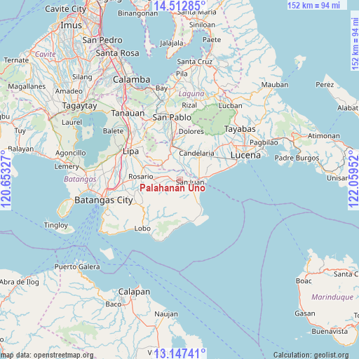
Palahanan Uno GPS coordinates[2]
13° 49' 52.068" North, 121° 21' 23.004" East
| Map corner | latitude | longitude |
|---|---|---|
| Upper-left | 14.51285°, | 120.65327° |
| Center: | 13.83113°, | 121.35639° |
| Lower-right: | 13.14741°, | 122.05952° |
| Map W x H: | 151.8×151.8 km | = 94.3×94.3mi |
| max Lat: | 20.78733° ⇑34% North |
| Palahanan Uno: | 13.83113° |
| min Lat: | ⇓66% South 4.65442° |
| min Long | Palahanan Uno | max Long |
| 117.04868° | 121.35639° | 126.58417° |
| W 30.7%⇐ | ⇒69.3% E |
Elevation
Elevation of Palahanan Uno is 31 m = 102 ft, and this is 56.9 m = 187 ft below average elevation for this country.
| Max E: |
2262 m = 7421 ft | 41.9% |
| Avg. | 87.9 m = 288 ft | |
| Palahanan Uno | 31 m = 102 ft | |
Min E: |
-2 m = -7 ft | 58.1% |
See also: Philippines elevation on elevation.city.
Geographical zone
Palahanan Uno is located in North Torrid zone (between Equator and Tropic of Cancer). Distance of this Northern Tropic circle is 1068 km =663.6 mi to North.| Distance of | km | miles | from Palahanan Uno |
|---|---|---|---|
| North Pole | 8469.2 | 5262.5 | to North |
| Arctic Circle | 5863.3 | 3643.3 | to North |
| Tropic Cancer | 1068 | 663.6 | to North |
| Equator | 1537.9 | 955.6 | to South |


Nearby cities:
15 places around Palahanan Uno: (largest is in red/bold)
• Alupay
5.6 km =3.5 mi,  288°
288°
• Cabay
5.1 km =3.2 mi,  29°
29°
• Libato
2.9 km =1.8 mi,  232°
232°
• Lipahan
4.9 km =3 mi,  82°
82°
• Macalamcam A
4.2 km =2.6 mi,  312°
312°
• Maugat West
8.6 km =5.3 mi, 292°
• Pinagsibaan
3.8 km =2.4 mi,  276°
276°
• Putingkahoy
3.1 km =1.9 mi,  268°
268°
• Quipot
7.3 km =4.5 mi,  142°
142°
• Sampiro
6 km =3.7 mi,  150°
150°
• San Juan
4.5 km =2.8 mi,  86°
86°
• Santa Catalina Norte
4.4 km =2.7 mi,  1°
1°
• Sico Uno
1.6 km =1 mi, 94°
• Talahiban I
3.8 km =2.4 mi, 135°
• Tipaz
7.4 km =4.6 mi, 92°
Sources, notices
• [Note1] Compared only with cities in Philippines existing in our database
• [Src1] Map data: © OpenStreetMap contributors (CC-BY-SA)
• [Src2] Other city data from geonames.org with taken over terms of usage.
• [Src3] Geographical zone / Annual Mean Temperature by Robert A. Rohde @ Wikipedia
