Mansalay geodata
Mansalay (Mimaropa) is a seat of a third-order administrative division; located in Philippines in Asia/Manila (GMT+8) time zone. With population of 23,044 people, there are 339 cities with bigger population in this country. Compared to other cities in Philippines, 55% of cities are located further ↓South; 67.8% of cities are located further →East and 57.6% of cities have higher elevation than Mansalay. Note1
Administrative division(s):
- Level 1: Mimaropa
- Level 2: Province of Mindoro Oriental
- Level 3: Mansalay


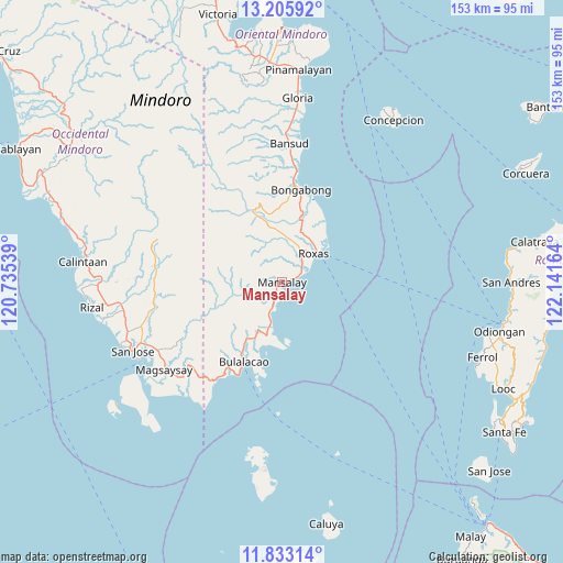
Mansalay GPS coordinates[2]
12° 31' 13.584" North, 121° 26' 18.636" East
| Map corner | latitude | longitude |
|---|---|---|
| Upper-left | 13.20592°, | 120.73539° |
| Center: | 12.52044°, | 121.43851° |
| Lower-right: | 11.83314°, | 122.14164° |
| Map W x H: | 152.6×152.6 km | = 94.8×94.8mi |
| max Lat: | 20.78733° ⇑45% North |
| Mansalay: | 12.52044° |
| min Lat: | ⇓55% South 4.65442° |
| min Long | Mansalay | max Long |
| 117.04868° | 121.43851° | 126.58417° |
| W 32.2%⇐ | ⇒67.8% E |
Elevation
Elevation of Mansalay is 18 m = 59 ft, and this is 69.9 m = 229 ft below average elevation for this country.
| Max E: |
2262 m = 7421 ft | 57.6% |
| Avg. | 87.9 m = 288 ft | |
| Mansalay | 18 m = 59 ft | |
Min E: |
-2 m = -7 ft | 42.4% |
See also: Philippines elevation on elevation.city.
Geographical zone
Mansalay is located in North Torrid zone (between Equator and Tropic of Cancer). Distance of this Northern Tropic circle is 1213.8 km =754.2 mi to North.| Distance of | km | miles | from Mansalay |
|---|---|---|---|
| North Pole | 8614.9 | 5353 | to North |
| Arctic Circle | 6009 | 3733.8 | to North |
| Tropic Cancer | 1213.8 | 754.2 | to North |
| Equator | 1392.1 | 865 | to South |


Nearby cities:
15 places around Mansalay: (largest is in red/bold)
• Anilao
23 km =14.3 mi,  20°
20°
• Balugo
6.5 km =4 mi,  0°
0°
• Bulalacao
24 km =14.9 mi,  205°
205°
• Cantel
13.5 km =8.4 mi,  37°
37°
• Cawayan
19 km =11.8 mi, 37°
• Malitbog
25.9 km =16.1 mi,  6°
6°
• Manaul
8.1 km =5 mi,  201°
201°
• Masaguisi
26 km =16.2 mi, 2°
• Odiong
10.7 km =6.6 mi, 40°
• Roxas
11.1 km =6.9 mi,  50°
50°
• Sagana
23.1 km =14.4 mi, 13°
• San Aquilino
10 km =6.2 mi,  31°
31°
• San Mariano
13.5 km =8.4 mi,  359°
359°
• Santa Brigida
7.6 km =4.7 mi, 46°
• Santa Maria
6.9 km =4.3 mi, 20°
Sources, notices
• [Note1] Compared only with cities in Philippines existing in our database
• [Src1] Map data: © OpenStreetMap contributors (CC-BY-SA)
• [Src2] Other city data from geonames.org with taken over terms of usage.
• [Src3] Geographical zone / Annual Mean Temperature by Robert A. Rohde @ Wikipedia
