Manaul geodata
Manaul (Mimaropa) is a populated place; located in Philippines in Asia/Manila (GMT+8) time zone. With population of 3,011 people, there are 2516 cities with bigger population in this country. Compared to other cities in Philippines, 54.5% of cities are located further ↓South; 68.4% of cities are located further →East and 54.5% of cities have higher elevation than Manaul. Note1
Administrative division(s):
- Level 1: Mimaropa
- Level 2: Province of Mindoro Oriental
- Level 3: Mansalay


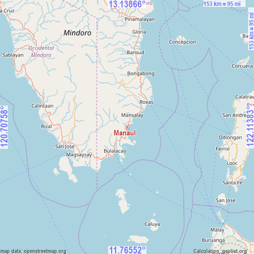
Manaul GPS coordinates[2]
12° 27' 10.8" North, 121° 24' 38.52" East
| Map corner | latitude | longitude |
|---|---|---|
| Upper-left | 13.13866°, | 120.70758° |
| Center: | 12.453°, | 121.4107° |
| Lower-right: | 11.76552°, | 122.11383° |
| Map W x H: | 152.7×152.7 km | = 94.9×94.9mi |
| max Lat: | 20.78733° ⇑45.5% North |
| Manaul: | 12.453° |
| min Lat: | ⇓54.5% South 4.65442° |
| min Long | Manaul | max Long |
| 117.04868° | 121.4107° | 126.58417° |
| W 31.6%⇐ | ⇒68.4% E |
Elevation
Elevation of Manaul is 20 m = 66 ft, and this is 67.9 m = 223 ft below average elevation for this country.
| Max E: |
2262 m = 7421 ft | 54.5% |
| Avg. | 87.9 m = 288 ft | |
| Manaul | 20 m = 66 ft | |
Min E: |
-2 m = -7 ft | 45.5% |
See also: Philippines elevation on elevation.city.
Geographical zone
Manaul is located in North Torrid zone (between Equator and Tropic of Cancer). Distance of this Northern Tropic circle is 1221.3 km =758.9 mi to North.| Distance of | km | miles | from Manaul |
|---|---|---|---|
| North Pole | 8622.4 | 5357.7 | to North |
| Arctic Circle | 6016.5 | 3738.5 | to North |
| Tropic Cancer | 1221.3 | 758.9 | to North |
| Equator | 1384.6 | 860.4 | to South |


Nearby cities:
15 places around Manaul: (largest is in red/bold)
• Anilao
31.1 km =19.3 mi,  20°
20°
• Balugo
14.4 km =8.9 mi,  12°
12°
• Bulalacao
16 km =9.9 mi,  207°
207°
• Cantel
21.4 km =13.3 mi,  31°
31°
• Cawayan
26.9 km =16.7 mi, 33°
• Mansalay
8.1 km =5 mi, 21°
• Mauhao
21.7 km =13.5 mi, 213°
• Odiong
18.5 km =11.5 mi, 32°
• Paclolo
27.1 km =16.8 mi,  251°
251°
• Roxas
18.6 km =11.6 mi,  38°
38°
• Sagana
31.1 km =19.3 mi, 15°
• San Aquilino
18.1 km =11.2 mi, 27°
• San Mariano
21.2 km =13.2 mi, 8°
• Santa Brigida
15.3 km =9.5 mi, 33°
• Santa Maria
15 km =9.3 mi, 21°
Sources, notices
• [Note1] Compared only with cities in Philippines existing in our database
• [Src1] Map data: © OpenStreetMap contributors (CC-BY-SA)
• [Src2] Other city data from geonames.org with taken over terms of usage.
• [Src3] Geographical zone / Annual Mean Temperature by Robert A. Rohde @ Wikipedia
