Maliig geodata
Maliig (Mimaropa) is a populated place; located in Philippines in Asia/Manila (GMT+8) time zone. With population of 2,837 people, there are 2727 cities with bigger population in this country. Compared to other cities in Philippines, 66.3% of cities are located further ↓South; 96.3% of cities are located further →East and 80.7% of cities have higher elevation than Maliig. Note1
Administrative division(s):
- Level 1: Mimaropa
- Level 2: Province of Mindoro Occidental
- Level 3: Lubang


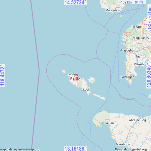
Maliig GPS coordinates[2]
13° 50' 44.016" North, 120° 9' 1.152" East
| Map corner | latitude | longitude |
|---|---|---|
| Upper-left | 14.52724°, | 119.4472° |
| Center: | 13.84556°, | 120.15032° |
| Lower-right: | 13.16188°, | 120.85345° |
| Map W x H: | 151.8×151.8 km | = 94.3×94.3mi |
| max Lat: | 20.78733° ⇑33.7% North |
| Maliig: | 13.84556° |
| min Lat: | ⇓66.3% South 4.65442° |
| min Long | Maliig | max Long |
| 117.04868° | 120.15032° | 126.58417° |
| W 3.7%⇐ | ⇒96.3% E |
Elevation
Elevation of Maliig is 9 m = 30 ft, and this is 78.9 m = 259 ft below average elevation for this country.
| Max E: |
2262 m = 7421 ft | 80.7% |
| Avg. | 87.9 m = 288 ft | |
| Maliig | 9 m = 30 ft | |
Min E: |
-2 m = -7 ft | 19.3% |
See also: Philippines elevation on elevation.city.
Geographical zone
Maliig is located in North Torrid zone (between Equator and Tropic of Cancer). Distance of this Northern Tropic circle is 1066.4 km =662.6 mi to North.| Distance of | km | miles | from Maliig |
|---|---|---|---|
| North Pole | 8467.6 | 5261.5 | to North |
| Arctic Circle | 5861.7 | 3642.3 | to North |
| Tropic Cancer | 1066.4 | 662.6 | to North |
| Equator | 1539.5 | 956.6 | to South |


Nearby cities:
15 places around Maliig: (largest is in red/bold)
• Balibago
52.1 km =32.4 mi,  80°
80°
• Balitoc
52.4 km =32.6 mi,  87°
87°
• Binubusan
54.2 km =33.7 mi, 75°
• Cabra
11.9 km =7.4 mi,  293°
293°
• Calatagan
52 km =32.3 mi, 91°
• Gulod
52.3 km =32.5 mi, 86°
• Harrison
53.6 km =33.3 mi,  145°
145°
• Looc
17.6 km =10.9 mi,  142°
142°
• Lubang
3.2 km =2 mi,  296°
296°
• Lucsuhin
53.2 km =33.1 mi, 85°
• Tagbak
6.7 km =4.2 mi,  266°
266°
• Talisay
51.6 km =32.1 mi, 81°
• Tangal
5.3 km =3.3 mi, 269°
• Tilik
6.4 km =4 mi,  122°
122°
• Vigo
3.8 km =2.4 mi, 123°
Sources, notices
• [Note1] Compared only with cities in Philippines existing in our database
• [Src1] Map data: © OpenStreetMap contributors (CC-BY-SA)
• [Src2] Other city data from geonames.org with taken over terms of usage.
• [Src3] Geographical zone / Annual Mean Temperature by Robert A. Rohde @ Wikipedia
