Malajog geodata
Malajog (Eastern Visayas) is a populated place; located in Philippines in Asia/Manila (GMT+8) time zone. With population of 2,196 people, there are 3895 cities with bigger population in this country. Compared to other cities in Philippines, 52.3% of cities are located further ↓South; 78.6% of cities are located further ←West and 89.7% of cities have higher elevation than Malajog. Note1
Administrative division(s):
- Level 1: Eastern Visayas
- Level 2: Province of Samar
- Level 3: Calbayog City


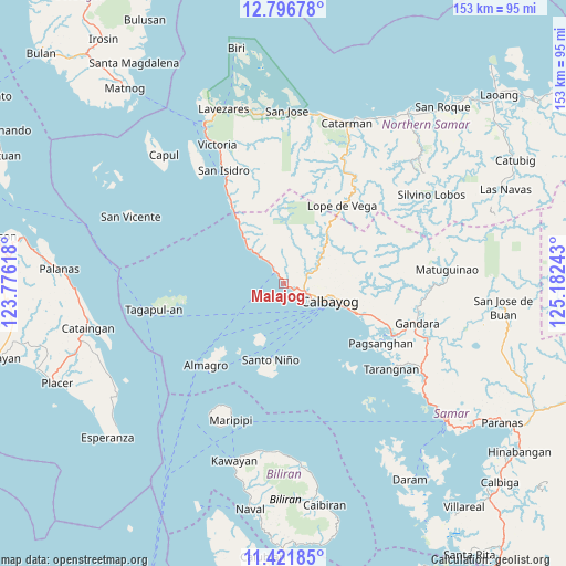
Malajog GPS coordinates[2]
12° 6' 36.72" North, 124° 28' 45.48" East
| Map corner | latitude | longitude |
|---|---|---|
| Upper-left | 12.79678°, | 123.77618° |
| Center: | 12.1102°, | 124.4793° |
| Lower-right: | 11.42185°, | 125.18243° |
| Map W x H: | 152.9×152.9 km | = 95×95mi |
| max Lat: | 20.78733° ⇑47.7% North |
| Malajog: | 12.1102° |
| min Lat: | ⇓52.3% South 4.65442° |
| min Long | Malajog | max Long |
| 117.04868° | 124.4793° | 126.58417° |
| W 78.6%⇐ | ⇒21.4% E |
Elevation
Elevation of Malajog is 7 m = 23 ft, and this is 80.9 m = 265 ft below average elevation for this country.
| Max E: |
2262 m = 7421 ft | 89.7% |
| Avg. | 87.9 m = 288 ft | |
| Malajog | 7 m = 23 ft | |
Min E: |
-2 m = -7 ft | 10.3% |
See also: Philippines elevation on elevation.city.
Geographical zone
Malajog is located in North Torrid zone (between Equator and Tropic of Cancer). Distance of this Northern Tropic circle is 1259.4 km =782.6 mi to North.| Distance of | km | miles | from Malajog |
|---|---|---|---|
| North Pole | 8660.5 | 5381.4 | to North |
| Arctic Circle | 6054.6 | 3762.2 | to North |
| Tropic Cancer | 1259.4 | 782.6 | to North |
| Equator | 1346.5 | 836.7 | to South |


Nearby cities:
15 places around Malajog: (largest is in red/bold)
• Almagro
30.6 km =19 mi,  223°
223°
• Calbayog City
13.6 km =8.5 mi,  110°
110°
• Lope de Vega
26.2 km =16.3 mi,  36°
36°
• Malaga
18.1 km =11.2 mi,  321°
321°
• Napuro
26.5 km =16.5 mi, 110°
• Pagsanghan
30.8 km =19.1 mi,  121°
121°
• Palanit
27.7 km =17.2 mi,  327°
327°
• Piña
12.3 km =7.6 mi, 316°
• Sabang
7.8 km =4.8 mi, 120°
• San Joaquin
8.3 km =5.2 mi, 319°
• San Policarpio
10.8 km =6.7 mi, 115°
• Santa Margarita
21 km =13 mi, 112°
• Santo Niño
20.7 km =12.9 mi,  189°
189°
• Tinambacan
3.1 km =1.9 mi,  125°
125°
• Viriato
24.3 km =15.1 mi, 325°
Sources, notices
• [Note1] Compared only with cities in Philippines existing in our database
• [Src1] Map data: © OpenStreetMap contributors (CC-BY-SA)
• [Src2] Other city data from geonames.org with taken over terms of usage.
• [Src3] Geographical zone / Annual Mean Temperature by Robert A. Rohde @ Wikipedia
