Santo Niño geodata
Santo Niño (Eastern Visayas) is a seat of a third-order administrative division; located in Philippines in Asia/Manila (GMT+8) time zone. With population of 2,864 people, there are 2687 cities with bigger population in this country. Compared to other cities in Philippines, 51.4% of cities are located further ↓South; 78.2% of cities are located further ←West and 97.1% of cities have higher elevation than Santo Niño. Note1


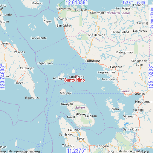
Santo Niño GPS coordinates[2]
11° 55' 34.68" North, 124° 26' 57.12" East
| Map corner | latitude | longitude |
|---|---|---|
| Upper-left | 12.61336°, | 123.74608° |
| Center: | 11.9263°, | 124.4492° |
| Lower-right: | 11.2375°, | 125.15233° |
| Map W x H: | 153×153 km | = 95.1×95.1mi |
| max Lat: | 20.78733° ⇑48.6% North |
| Santo Niño: | 11.9263° |
| min Lat: | ⇓51.4% South 4.65442° |
| min Long | Santo Niño | max Long |
| 117.04868° | 124.4492° | 126.58417° |
| W 78.2%⇐ | ⇒21.8% E |
Elevation
Elevation of Santo Niño is 4 m = 13 ft, and this is 83.9 m = 275 ft below average elevation for this country.
| Max E: |
2262 m = 7421 ft | 97.1% |
| Avg. | 87.9 m = 288 ft | |
| Santo Niño | 4 m = 13 ft | |
Min E: |
-2 m = -7 ft | 2.9% |
See also: Philippines elevation on elevation.city.
Geographical zone
Santo Niño is located in North Torrid zone (between Equator and Tropic of Cancer). Distance of this Northern Tropic circle is 1279.8 km =795.2 mi to North.| Distance of | km | miles | from Santo Niño |
|---|---|---|---|
| North Pole | 8681 | 5394.1 | to North |
| Arctic Circle | 6075.1 | 3774.9 | to North |
| Tropic Cancer | 1279.8 | 795.2 | to North |
| Equator | 1326.1 | 824 | to South |


Nearby cities:
15 places around Santo Niño: (largest is in red/bold)
• Almagro
17.9 km =11.1 mi,  264°
264°
• Calbayog City
22.4 km =13.9 mi,  45°
45°
• Culaba
31.5 km =19.6 mi,  161°
161°
• Kawayan
29.2 km =18.1 mi,  200°
200°
• Malajog
20.7 km =12.9 mi,  9°
9°
• Maripipi
19.6 km =12.2 mi,  213°
213°
• Napuro
30.3 km =18.8 mi,  68°
68°
• Pagsanghan
29.9 km =18.6 mi,  81°
81°
• Piña
29.9 km =18.6 mi,  349°
349°
• Sabang
19.3 km =12 mi,  31°
31°
• San Joaquin
26.8 km =16.7 mi,  355°
355°
• San Policarpio
20.5 km =12.7 mi,  39°
39°
• Santa Margarita
25.9 km =16.1 mi,  61°
61°
• Tinambacan
19.6 km =12.2 mi,  17°
17°
• Tucdao
25.2 km =15.7 mi,  174°
174°
Sources, notices
• [Note1] Compared only with cities in Philippines existing in our database
• [Src1] Map data: © OpenStreetMap contributors (CC-BY-SA)
• [Src2] Other city data from geonames.org with taken over terms of usage.
• [Src3] Geographical zone / Annual Mean Temperature by Robert A. Rohde @ Wikipedia
