Magbay geodata
Magbay (Mimaropa) is a populated place; located in Philippines in Asia/Manila (GMT+8) time zone. With population of 3,248 people, there are 2258 cities with bigger population in this country. Compared to other cities in Philippines, 54.2% of cities are located further ↓South; 74.1% of cities are located further →East and 54.5% of cities have higher elevation than Magbay. Note1
Administrative division(s):
- Level 1: Mimaropa
- Level 2: Province of Mindoro Occidental
- Level 3: San Jose


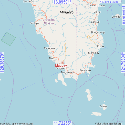
Magbay GPS coordinates[2]
12° 24' 36.504" North, 121° 5' 23.676" East
| Map corner | latitude | longitude |
|---|---|---|
| Upper-left | 13.09591°, | 120.38679° |
| Center: | 12.41014°, | 121.08991° |
| Lower-right: | 11.72255°, | 121.79304° |
| Map W x H: | 152.7×152.7 km | = 94.9×94.9mi |
| max Lat: | 20.78733° ⇑45.8% North |
| Magbay: | 12.41014° |
| min Lat: | ⇓54.2% South 4.65442° |
| min Long | Magbay | max Long |
| 117.04868° | 121.08991° | 126.58417° |
| W 25.9%⇐ | ⇒74.1% E |
Elevation
Elevation of Magbay is 20 m = 66 ft, and this is 67.9 m = 223 ft below average elevation for this country.
| Max E: |
2262 m = 7421 ft | 54.5% |
| Avg. | 87.9 m = 288 ft | |
| Magbay | 20 m = 66 ft | |
Min E: |
-2 m = -7 ft | 45.5% |
See also: Philippines elevation on elevation.city.
Geographical zone
Magbay is located in North Torrid zone (between Equator and Tropic of Cancer). Distance of this Northern Tropic circle is 1226 km =761.8 mi to North.| Distance of | km | miles | from Magbay |
|---|---|---|---|
| North Pole | 8627.2 | 5360.7 | to North |
| Arctic Circle | 6021.3 | 3741.5 | to North |
| Tropic Cancer | 1226 | 761.8 | to North |
| Equator | 1379.9 | 857.4 | to South |


Nearby cities:
15 places around Magbay: (largest is in red/bold)
• Adela
13.2 km =8.2 mi,  285°
285°
• Babug
6.7 km =4.2 mi,  231°
231°
• Bagong Sikat
5.6 km =3.5 mi,  212°
212°
• Calintaan
24.3 km =15.1 mi,  315°
315°
• Caminauit
8.8 km =5.5 mi,  185°
185°
• La Curva
4.8 km =3 mi,  262°
262°
• Magsaysay
10.7 km =6.6 mi,  142°
142°
• Mangarine
6.6 km =4.1 mi,  172°
172°
• Paclolo
9.8 km =6.1 mi,  112°
112°
• Pitogo
10.8 km =6.7 mi,  0°
0°
• Rizal
14.8 km =9.2 mi,  295°
295°
• San Agustin
11 km =6.8 mi,  275°
275°
• San Jose
6.8 km =4.2 mi,  200°
200°
• San Pedro
10.3 km =6.4 mi, 303°
• Santa Teresa
17.8 km =11.1 mi, 172°
Sources, notices
• [Note1] Compared only with cities in Philippines existing in our database
• [Src1] Map data: © OpenStreetMap contributors (CC-BY-SA)
• [Src2] Other city data from geonames.org with taken over terms of usage.
• [Src3] Geographical zone / Annual Mean Temperature by Robert A. Rohde @ Wikipedia
