San Quintin geodata
San Quintin (Cordillera) is a seat of a third-order administrative division; located in Philippines in Asia/Manila (GMT+8) time zone. In our database, there are 4166 cities with bigger population. Compared to other cities in Philippines, 96.3% of cities are located further ↓South; 90.4% of cities are located further →East and 60.9% of cities have lower elevation than San Quintin. Note1


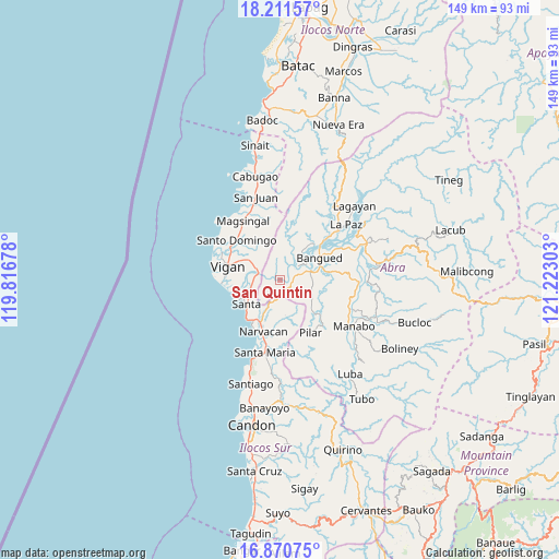
San Quintin GPS coordinates[2]
17° 32' 32.64" North, 120° 31' 11.64" East
| Map corner | latitude | longitude |
|---|---|---|
| Upper-left | 18.21157°, | 119.81678° |
| Center: | 17.5424°, | 120.5199° |
| Lower-right: | 16.87075°, | 121.22303° |
| Map W x H: | 149.1×149.1 km | = 92.6×92.6mi |
| max Lat: | 20.78733° ⇑3.7% North |
| San Quintin: | 17.5424° |
| min Lat: | ⇓96.3% South 4.65442° |
| min Long | San Quintin | max Long |
| 117.04868° | 120.5199° | 126.58417° |
| W 9.6%⇐ | ⇒90.4% E |
Elevation
Elevation of San Quintin is 35 m = 115 ft, and this is 52.9 m = 174 ft below average elevation for this country.
| Max E: |
2262 m = 7421 ft | 39.1% |
| Avg. | 87.9 m = 288 ft | |
| San Quintin | 35 m = 115 ft | |
Min E: |
-2 m = -7 ft | 60.9% |
See also: Philippines elevation on elevation.city.
Geographical zone
San Quintin is located in North Torrid zone (between Equator and Tropic of Cancer). Distance of this Northern Tropic circle is 655.4 km =407.2 mi to North.| Distance of | km | miles | from San Quintin |
|---|---|---|---|
| North Pole | 8056.5 | 5006.1 | to North |
| Arctic Circle | 5450.6 | 3386.8 | to North |
| Tropic Cancer | 655.4 | 407.2 | to North |
| Equator | 1950.5 | 1212 | to South |


Nearby cities:
15 places around San Quintin: (largest is in red/bold)
• Angad
12.2 km =7.6 mi,  67°
67°
• Bangued
14.5 km =9 mi,  59°
59°
• Bantay
14.6 km =9.1 mi,  288°
288°
• Calaba
13.2 km =8.2 mi,  50°
50°
• Caoayan
13.2 km =8.2 mi,  279°
279°
• Langiden
6.1 km =3.8 mi, 50°
• Lungog
9.7 km =6 mi,  206°
206°
• Mabilbila Sur
9.2 km =5.7 mi,  244°
244°
• Nagbukel
10.6 km =6.6 mi,  177°
177°
• Peñarrubia
14.2 km =8.8 mi,  79°
79°
• Pidigan
8.1 km =5 mi, 67°
• Quinarayan
12 km =7.5 mi,  204°
204°
• San Isidro
12.4 km =7.7 mi,  134°
134°
• Santa
11 km =6.8 mi, 235°
• Vigan
14.5 km =9 mi, 284°
Sources, notices
• [Note1] Compared only with cities in Philippines existing in our database
• [Src1] Map data: © OpenStreetMap contributors (CC-BY-SA)
• [Src2] Other city data from geonames.org with taken over terms of usage.
• [Src3] Geographical zone / Annual Mean Temperature by Robert A. Rohde @ Wikipedia
