Lumangbayan geodata
Lumangbayan (Mimaropa) is a populated place; located in Philippines in Asia/Manila (GMT+8) time zone. With population of 2,552 people, there are 3207 cities with bigger population in this country. Compared to other cities in Philippines, 57.8% of cities are located further ↓South; 66.5% of cities are located further →East and 85.4% of cities have higher elevation than Lumangbayan. Note1
Administrative division(s):
- Level 1: Mimaropa
- Level 2: Province of Mindoro Oriental
- Level 3: Pinamalayan


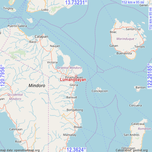
Lumangbayan GPS coordinates[2]
13° 2' 53.88" North, 121° 29' 55.392" East
| Map corner | latitude | longitude |
|---|---|---|
| Upper-left | 13.73231°, | 120.7956° |
| Center: | 13.0483°, | 121.49872° |
| Lower-right: | 12.3624°, | 122.20185° |
| Map W x H: | 152.3×152.3 km | = 94.6×94.6mi |
| max Lat: | 20.78733° ⇑42.2% North |
| Lumangbayan: | 13.0483° |
| min Lat: | ⇓57.8% South 4.65442° |
| min Long | Lumangbayan | max Long |
| 117.04868° | 121.49872° | 126.58417° |
| W 33.5%⇐ | ⇒66.5% E |
Elevation
Elevation of Lumangbayan is 8 m = 26 ft, and this is 79.9 m = 262 ft below average elevation for this country.
| Max E: |
2262 m = 7421 ft | 85.4% |
| Avg. | 87.9 m = 288 ft | |
| Lumangbayan | 8 m = 26 ft | |
Min E: |
-2 m = -7 ft | 14.6% |
See also: Philippines elevation on elevation.city.
Geographical zone
Lumangbayan is located in North Torrid zone (between Equator and Tropic of Cancer). Distance of this Northern Tropic circle is 1155.1 km =717.7 mi to North.| Distance of | km | miles | from Lumangbayan |
|---|---|---|---|
| North Pole | 8556.2 | 5316.6 | to North |
| Arctic Circle | 5950.3 | 3697.3 | to North |
| Tropic Cancer | 1155.1 | 717.7 | to North |
| Equator | 1450.8 | 901.5 | to South |


Nearby cities:
15 places around Lumangbayan: (largest is in red/bold)
• Bayuin
12 km =7.5 mi,  266°
266°
• Calamundingan
13.4 km =8.3 mi,  193°
193°
• Gloria
8 km =5 mi,  205°
205°
• Leuteboro
13.5 km =8.4 mi,  276°
276°
• Malamig
18 km =11.2 mi,  232°
232°
• Maluanluan
9.8 km =6.1 mi,  303°
303°
• Pambisan
10.1 km =6.3 mi,  247°
247°
• Pangulayan
5.6 km =3.5 mi,  260°
260°
• Pili
3.1 km =1.9 mi,  49°
49°
• Pinamalayan
4 km =2.5 mi, 266°
• Pola
12.3 km =7.6 mi,  329°
329°
• Quinabigan
6.5 km =4 mi,  200°
200°
• Saaban
16.8 km =10.4 mi, 302°
• Socorro
11 km =6.8 mi, 280°
• Tambong
9.5 km =5.9 mi, 189°
Sources, notices
• [Note1] Compared only with cities in Philippines existing in our database
• [Src1] Map data: © OpenStreetMap contributors (CC-BY-SA)
• [Src2] Other city data from geonames.org with taken over terms of usage.
• [Src3] Geographical zone / Annual Mean Temperature by Robert A. Rohde @ Wikipedia
