Looc geodata
Looc (Northern Mindanao) is a populated place; located in Philippines in Asia/Manila (GMT+8) time zone. With population of 2,292 people, there are 3702 cities with bigger population in this country. Compared to other cities in Philippines, 76.8% of cities are located further ↑North; 84.3% of cities are located further ←West and 78.9% of cities have lower elevation than Looc. Note1
Administrative division(s):
- Level 1: Northern Mindanao
- Level 2: Province of Misamis Oriental
- Level 3: Salay


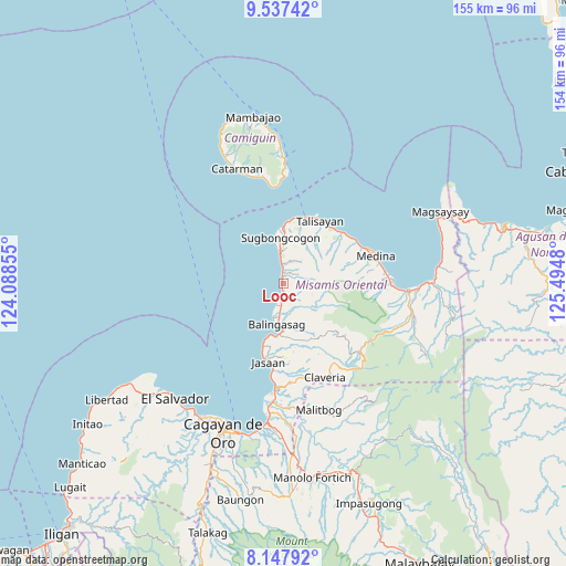
Looc GPS coordinates[2]
8° 50' 35.988" North, 124° 47' 30.012" East
| Map corner | latitude | longitude |
|---|---|---|
| Upper-left | 9.53742°, | 124.08855° |
| Center: | 8.84333°, | 124.79167° |
| Lower-right: | 8.14792°, | 125.4948° |
| Map W x H: | 154.5×154.5 km | = 96×96mi |
| max Lat: | 20.78733° ⇑76.8% North |
| Looc: | 8.84333° |
| min Lat: | ⇓23.2% South 4.65442° |
| min Long | Looc | max Long |
| 117.04868° | 124.79167° | 126.58417° |
| W 84.3%⇐ | ⇒15.7% E |
Elevation
Elevation of Looc is 85 m = 279 ft, and this is 2.9 m = 10 ft below average elevation for this country.
| Max E: |
2262 m = 7421 ft | 21.1% |
| Avg. | 87.9 m = 288 ft | |
| Looc | 85 m = 279 ft | |
Min E: |
-2 m = -7 ft | 78.9% |
See also: Philippines elevation on elevation.city.
Geographical zone
Looc is located in North Torrid zone (between Equator and Tropic of Cancer). Distance of Equator is 983.3 km =611 mi to South.| Distance of | km | miles | from Looc |
|---|---|---|---|
| North Pole | 9023.8 | 5607.1 | to North |
| Arctic Circle | 6417.9 | 3987.9 | to North |
| Tropic Cancer | 1622.6 | 1008.2 | to North |
| Equator | 983.3 | 611 | to South |


Nearby cities:
15 places around Looc: (largest is in red/bold)
• Balingasag
11.1 km =6.9 mi,  188°
188°
• Baliwagan
13.9 km =8.6 mi,  180°
180°
• Binitinan
14.9 km =9.3 mi, 186°
• Binuangan
8 km =5 mi,  357°
357°
• Inobulan
4.8 km =3 mi,  4°
4°
• Kauswagan
6.2 km =3.9 mi,  196°
196°
• Kinogitan
15.8 km =9.8 mi, 0°
• Lagonglong
4 km =2.5 mi, 182°
• Mambayaan
6.8 km =4.2 mi, 186°
• Mananum
17.4 km =10.8 mi,  93°
93°
• Mandangoa
7.8 km =4.8 mi, 180°
• Napalitan
7.7 km =4.8 mi,  171°
171°
• Salay
1.8 km =1.1 mi,  351°
351°
• Sugbongkogon
12.6 km =7.8 mi, 359°
• Taboc
3.9 km =2.4 mi,  9°
9°
Sources, notices
• [Note1] Compared only with cities in Philippines existing in our database
• [Src1] Map data: © OpenStreetMap contributors (CC-BY-SA)
• [Src2] Other city data from geonames.org with taken over terms of usage.
• [Src3] Geographical zone / Annual Mean Temperature by Robert A. Rohde @ Wikipedia
