Baliwagan geodata
Baliwagan (Northern Mindanao) is a populated place; located in Philippines in Asia/Manila (GMT+8) time zone. With population of 2,838 people, there are 2724 cities with bigger population in this country. Compared to other cities in Philippines, 77.2% of cities are located further ↑North; 84.2% of cities are located further ←West and 100% of cities have higher elevation than Baliwagan. Note1
Administrative division(s):
- Level 1: Northern Mindanao
- Level 2: Province of Misamis Oriental
- Level 3: Balingasag


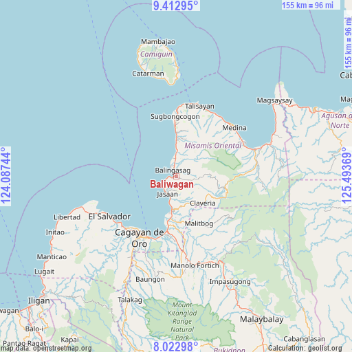
Baliwagan GPS coordinates[2]
8° 43' 6.996" North, 124° 47' 26.016" East
| Map corner | latitude | longitude |
|---|---|---|
| Upper-left | 9.41295°, | 124.08744° |
| Center: | 8.71861°, | 124.79056° |
| Lower-right: | 8.02298°, | 125.49369° |
| Map W x H: | 154.6×154.6 km | = 96.1×96.1mi |
| max Lat: | 20.78733° ⇑77.2% North |
| Baliwagan: | 8.71861° |
| min Lat: | ⇓22.8% South 4.65442° |
| min Long | Baliwagan | max Long |
| 117.04868° | 124.79056° | 126.58417° |
| W 84.2%⇐ | ⇒15.8% E |
Elevation
Elevation of Baliwagan is 0 m = 0 ft, and this is 87.9 m = 288 ft below average elevation for this country.
| Max E: |
2262 m = 7421 ft | 100% |
| Avg. | 87.9 m = 288 ft | |
| Baliwagan | 0 m = 0 ft | |
Min E: |
-2 m = -7 ft | 0% |
See also: Philippines elevation on elevation.city.
Geographical zone
Baliwagan is located in North Torrid zone (between Equator and Tropic of Cancer). Distance of Equator is 969.4 km =602.4 mi to South.| Distance of | km | miles | from Baliwagan |
|---|---|---|---|
| North Pole | 9037.6 | 5615.7 | to North |
| Arctic Circle | 6431.8 | 3996.5 | to North |
| Tropic Cancer | 1636.5 | 1016.9 | to North |
| Equator | 969.4 | 602.4 | to South |


Nearby cities:
15 places around Baliwagan: (largest is in red/bold)
• Ani-e
14.6 km =9.1 mi,  143°
143°
• Aplaya
12.5 km =7.8 mi,  191°
191°
• Balingasag
3.2 km =2 mi,  332°
332°
• Binitinan
1.9 km =1.2 mi,  239°
239°
• Hinapalanan
12.6 km =7.8 mi,  133°
133°
• Jasaan
8.1 km =5 mi,  208°
208°
• Kauswagan
8.1 km =5 mi,  348°
348°
• Lagonglong
9.9 km =6.2 mi,  359°
359°
• Looc
13.9 km =8.6 mi,  0°
0°
• Mambayaan
7.2 km =4.5 mi, 354°
• Mandangoa
6 km =3.7 mi, 0°
• Napalitan
6.4 km =4 mi,  11°
11°
• Patrocinio
13.3 km =8.3 mi,  152°
152°
• Solana
10.8 km =6.7 mi, 191°
• Villanueva
14.5 km =9 mi, 186°
Sources, notices
• [Note1] Compared only with cities in Philippines existing in our database
• [Src1] Map data: © OpenStreetMap contributors (CC-BY-SA)
• [Src2] Other city data from geonames.org with taken over terms of usage.
• [Src3] Geographical zone / Annual Mean Temperature by Robert A. Rohde @ Wikipedia
