Linmansangan geodata
Linmansangan (Ilocos) is a populated place; located in Philippines in Asia/Manila (GMT+8) time zone. With population of 3,872 people, there are 1798 cities with bigger population in this country. Compared to other cities in Philippines, 85.2% of cities are located further ↓South; 95.4% of cities are located further →East and 62.8% of cities have higher elevation than Linmansangan. Note1


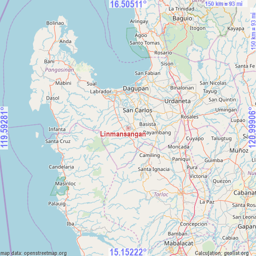
Linmansangan GPS coordinates[2]
15° 49' 47.28" North, 120° 17' 45.348" East
| Map corner | latitude | longitude |
|---|---|---|
| Upper-left | 16.50511°, | 119.59281° |
| Center: | 15.8298°, | 120.29593° |
| Lower-right: | 15.15222°, | 120.99906° |
| Map W x H: | 150.4×150.4 km | = 93.5×93.5mi |
| max Lat: | 20.78733° ⇑14.8% North |
| Linmansangan: | 15.8298° |
| min Lat: | ⇓85.2% South 4.65442° |
| min Long | Linmansangan | max Long |
| 117.04868° | 120.29593° | 126.58417° |
| W 4.6%⇐ | ⇒95.4% E |
Elevation
Elevation of Linmansangan is 15 m = 49 ft, and this is 72.9 m = 239 ft below average elevation for this country.
| Max E: |
2262 m = 7421 ft | 62.8% |
| Avg. | 87.9 m = 288 ft | |
| Linmansangan | 15 m = 49 ft | |
Min E: |
-2 m = -7 ft | 37.2% |
See also: Philippines elevation on elevation.city.
Geographical zone
Linmansangan is located in North Torrid zone (between Equator and Tropic of Cancer). Distance of this Northern Tropic circle is 845.8 km =525.6 mi to North.| Distance of | km | miles | from Linmansangan |
|---|---|---|---|
| North Pole | 8247 | 5124.4 | to North |
| Arctic Circle | 5641.1 | 3505.2 | to North |
| Tropic Cancer | 845.8 | 525.6 | to North |
| Equator | 1760.1 | 1093.7 | to South |


Nearby cities:
15 places around Linmansangan: (largest is in red/bold)
• Angatel
5.7 km =3.5 mi,  117°
117°
• Bacnar
8.1 km =5 mi,  39°
39°
• Bayaoas
3.4 km =2.1 mi,  278°
278°
• Calsib
3.9 km =2.4 mi,  299°
299°
• Dorongan Punta
3.3 km =2.1 mi, 120°
• Isla
7.3 km =4.5 mi,  4°
4°
• Libas
5.8 km =3.6 mi,  22°
22°
• Malibong East
3.8 km =2.4 mi,  60°
60°
• Mangatarem
4.7 km =2.9 mi,  184°
184°
• Ninoy
6.1 km =3.8 mi, 302°
• Pogonsili
4 km =2.5 mi,  254°
254°
• Real
5.8 km =3.6 mi,  113°
113°
• Tamayo
5.4 km =3.4 mi,  347°
347°
• Tocok
8.9 km =5.5 mi, 177°
• Urbiztondo
3.7 km =2.3 mi,  102°
102°
Sources, notices
• [Note1] Compared only with cities in Philippines existing in our database
• [Src1] Map data: © OpenStreetMap contributors (CC-BY-SA)
• [Src2] Other city data from geonames.org with taken over terms of usage.
• [Src3] Geographical zone / Annual Mean Temperature by Robert A. Rohde @ Wikipedia
