Kalibo (poblacion) geodata
Kalibo (poblacion) (Western Visayas) is a populated place; located in Philippines in Asia/Manila (GMT+8) time zone. With population of 56,845 people, there are 163 cities with bigger population in this country. Compared to other cities in Philippines, 50.4% of cities are located further ↓South; 56.7% of cities are located further →East and 70.2% of cities have higher elevation than Kalibo (poblacion). Note1


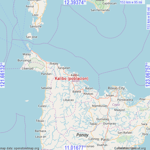
Kalibo (poblacion) GPS coordinates[2]
11° 42' 21.996" North, 122° 21' 51.984" East
| Map corner | latitude | longitude |
|---|---|---|
| Upper-left | 12.39374°, | 121.66132° |
| Center: | 11.70611°, | 122.36444° |
| Lower-right: | 11.01677°, | 123.06757° |
| Map W x H: | 153.1×153.1 km | = 95.1×95.1mi |
| max Lat: | 20.78733° ⇑49.6% North |
| Kalibo (poblacion): | 11.70611° |
| min Lat: | ⇓50.4% South 4.65442° |
| min Long | Kalibo (poblaci | max Long |
| 117.04868° | 122.36444° | 126.58417° |
| W 43.3%⇐ | ⇒56.7% E |
Elevation
Elevation of Kalibo (poblacion) is 12 m = 39 ft, and this is 75.9 m = 249 ft below average elevation for this country.
| Max E: |
2262 m = 7421 ft | 70.2% |
| Avg. | 87.9 m = 288 ft | |
| Kalibo (poblacion) | 12 m = 39 ft | |
Min E: |
-2 m = -7 ft | 29.8% |
See also: Kalibo (poblacion) elevation on elevation.city.
Geographical zone
Kalibo (poblacion) is located in North Torrid zone (between Equator and Tropic of Cancer). Distance of Equator is 1301.6 km =808.8 mi to South.| Distance of | km | miles | from Kalibo (poblacion) |
|---|---|---|---|
| North Pole | 8705.5 | 5409.3 | to North |
| Arctic Circle | 6099.6 | 3790.1 | to North |
| Tropic Cancer | 1304.3 | 810.5 | to North |
| Equator | 1301.6 | 808.8 | to South |


Nearby cities:
15 places around Kalibo (poblacion): (largest is in red/bold)
• Bañga
8.2 km =5.1 mi,  203°
203°
• Brgy. Bachaw Norte, Kalibo
2 km =1.2 mi,  48°
48°
• Brgy. Bubog, Numancia
1.7 km =1.1 mi,  286°
286°
• Brgy. Bulwang, Numancia
1.8 km =1.1 mi,  348°
348°
• Brgy. Mabilo, New Washington
5.6 km =3.5 mi,  123°
123°
• Brgy. Nalook, kalibo
2.3 km =1.4 mi,  167°
167°
• Brgy. New Buswang, Kalibo
2.3 km =1.4 mi,  72°
72°
• Brgy. Tinigao, Kalibo
0.7 km =0.4 mi,  160°
160°
• Dungon
5.5 km =3.4 mi, 285°
• Guinoaliuan
5.8 km =3.6 mi, 157°
• Linabuan
6.2 km =3.9 mi,  187°
187°
• Linabuan Sur
6.5 km =4 mi, 199°
• Makato
7.9 km =4.9 mi,  274°
274°
• Numancia
3.9 km =2.4 mi, 269°
• Tambac
6.4 km =4 mi,  127°
127°
Sources, notices
• [Note1] Compared only with cities in Philippines existing in our database
• [Src1] Map data: © OpenStreetMap contributors (CC-BY-SA)
• [Src2] Other city data from geonames.org with taken over terms of usage.
• [Src3] Geographical zone / Annual Mean Temperature by Robert A. Rohde @ Wikipedia
