Guinoaliuan geodata
Guinoaliuan (Western Visayas) is a populated place; located in Philippines in Asia/Manila (GMT+8) time zone. With population of 2,503 people, there are 3279 cities with bigger population in this country. Compared to other cities in Philippines, 50.1% of cities are located further ↓South; 56.3% of cities are located further →East and 80.7% of cities have higher elevation than Guinoaliuan. Note1
Administrative division(s):
- Level 1: Western Visayas
- Level 2: Province of Aklan
- Level 3: New Washington


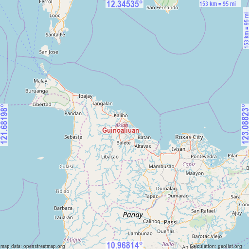
Guinoaliuan GPS coordinates[2]
11° 39' 27.36" North, 122° 23' 6.36" East
| Map corner | latitude | longitude |
|---|---|---|
| Upper-left | 12.34535°, | 121.68198° |
| Center: | 11.6576°, | 122.3851° |
| Lower-right: | 10.96814°, | 123.08823° |
| Map W x H: | 153.1×153.1 km | = 95.1×95.1mi |
| max Lat: | 20.78733° ⇑49.9% North |
| Guinoaliuan: | 11.6576° |
| min Lat: | ⇓50.1% South 4.65442° |
| min Long | Guinoaliuan | max Long |
| 117.04868° | 122.3851° | 126.58417° |
| W 43.7%⇐ | ⇒56.3% E |
Elevation
Elevation of Guinoaliuan is 9 m = 30 ft, and this is 78.9 m = 259 ft below average elevation for this country.
| Max E: |
2262 m = 7421 ft | 80.7% |
| Avg. | 87.9 m = 288 ft | |
| Guinoaliuan | 9 m = 30 ft | |
Min E: |
-2 m = -7 ft | 19.3% |
See also: Philippines elevation on elevation.city.
Geographical zone
Guinoaliuan is located in North Torrid zone (between Equator and Tropic of Cancer). Distance of Equator is 1296.2 km =805.4 mi to South.| Distance of | km | miles | from Guinoaliuan |
|---|---|---|---|
| North Pole | 8710.9 | 5412.7 | to North |
| Arctic Circle | 6105 | 3793.5 | to North |
| Tropic Cancer | 1309.7 | 813.8 | to North |
| Equator | 1296.2 | 805.4 | to South |


Nearby cities:
15 places around Guinoaliuan: (largest is in red/bold)
• Bañga
5.9 km =3.7 mi,  249°
249°
• Brgy. Bachaw Norte, Kalibo
6.8 km =4.2 mi,  353°
353°
• Brgy. Bubog, Numancia
7 km =4.3 mi,  326°
326°
• Brgy. Bulwang, Numancia
7.6 km =4.7 mi,  339°
339°
• Brgy. Mabilo, New Washington
3.3 km =2.1 mi,  47°
47°
• Brgy. Nalook, kalibo
3.6 km =2.2 mi, 331°
• Brgy. New Buswang, Kalibo
6.1 km =3.8 mi,  359°
359°
• Brgy. Tinigao, Kalibo
5.1 km =3.2 mi, 336°
• Kalibo (poblacion)
5.8 km =3.6 mi, 337°
• Linabuan
3.1 km =1.9 mi,  256°
256°
• Linabuan Sur
4.4 km =2.7 mi, 260°
• New Washington
5.2 km =3.2 mi,  98°
98°
• Numancia
8.2 km =5.1 mi,  311°
311°
• Tambac
3.2 km =2 mi,  63°
63°
• Tugas
5 km =3.1 mi,  183°
183°
Sources, notices
• [Note1] Compared only with cities in Philippines existing in our database
• [Src1] Map data: © OpenStreetMap contributors (CC-BY-SA)
• [Src2] Other city data from geonames.org with taken over terms of usage.
• [Src3] Geographical zone / Annual Mean Temperature by Robert A. Rohde @ Wikipedia
